 Catálogo de datos del IEO
Keyword
Oceanographic geographical features
5758 record(s)
Type of resources
Categories
Available actions
Topics
INSPIRE themes
Keywords
Contact for the resource
Provided by
Years
Formats
Status
Scale
From
1
-
10
/
5758
-
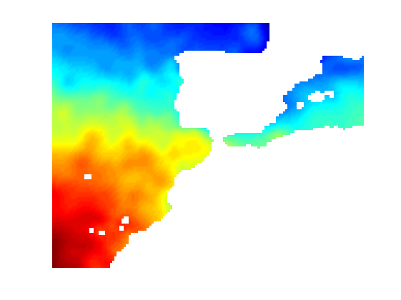
Climatología mensual de salinidad para la zona de Península Ibérica, Baleares e Islas canarias, con resolución espacial de 0.2º y 33 niveles verticales.
-
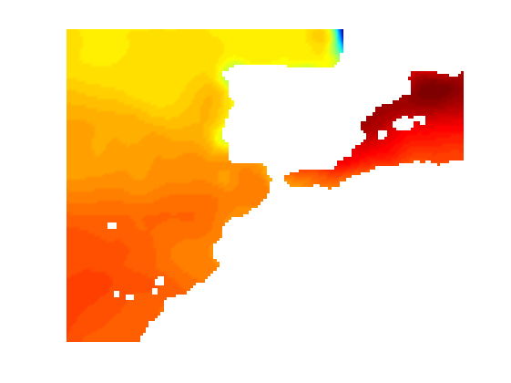
Climatología mensual de temperatura para la zona de Península Ibérica, Baleares e Islas canarias, con resolución espacial de 0.2º y 33 niveles verticales.
-

Effect of temperature on the structure and metabolism of Antarctic plankton communities
-
Geophysical and geological reconnaissance of the continental margin NorIbérico
-
Strata formation in the European continental margin
-
N/A
-
N/A
-
N/A
-
Integrated geological and geophysical studies in margins and sedimentary basins of southern Iberia.
-
Tectonics, structure and morphology of the Basins and Margins Alboran Sea and South Balearic