Type
series
4302 record(s)
Type of resources
Categories
Topics
INSPIRE themes
Keywords
Contact for the resource
Provided by
Years
Formats
Status
-
<p>The Protevs Swot 2018 campaign aimed to explore the South Balearic zone in early spring to observe the small scales of the oceanic mixed layer using high-resolution sampling devices.</p> <p>The area was chosen because it was positioned below the SWOT satellite's planned swath in its validation/calibration period. In this sense, it is a precursor experiment of experiments for the year 2022 and as such exploratory of the scales that will be observable by this newly designed altimetry satellite.</p> <p>A particular focus was placed on an anticyclonic structure in the southern Balearic Islands that is systematically detectable by altimetry but which appears to be an artifact.</p> <p>These samplings were combined with fine analysis of the surface content of small phytoplankton by flow cytometry to study the shaping of the marine landscape by frontal physical processes.</p> <p> </p>
-
The aims of this cruise were to elucidate the processes responsible for controlling iodocarbon concentrations and provide a dataset that can be used to develop modelled estimates of iodocarbon sea-air fluxes in tropical Atlantic waters.
-
This equipment trials cruise has provided opportunities for test and verification of technology under development at the Proudman Oceanographic Laboratory (POL), the Scottish Association for Marine Science (SAMS) and the National Oceanography Centre, Southampton (NOC,S). This includes equipment developed during the first year of funding under OCEANS 2025 (theme 8). Testing technology in the ocean environment is invaluable in assessing fitness for purpose. Specifically, the cruise tested: A Spar wave buoy (NOC,S) biogeochemical sensors (NOC,S); an UAV system (NOC,S); a video grab system "HyBis" (NOC,S), A benthic Multicore (NOC,S), A benthic lander and associated torroidal Telemetry buoy (POL), and a shallow tow towfish (POL). Testing in Spanish waters (near Tenerife, Gran Canaria and Fuerteventura) has been invaluable. The time on passage has been minimised (the transition from deep to shallow water is less than a days steaming) and the calm conditions to the southwest of the islands in the consistent prevailing north easterly winds have enabled deployment and recovery techniques to be tried and optimised in safety.
-
Overall objectives in the EU GO project are to assess the promising potential of seismic imaging for physical oceanography, in view of its combination of fine resolution and coverage unmatched by conventional oceanographic measurements. D318 was to provide the means of assessment by obtaining a unique, comprehensive, oceanographic and seismic dataset at the same time and place. Specific objectives for R.R.S. Discovery cruise 318a were to deploy four ADCP moorings, three adjacent temperature-logger moorings and STABLE, in an L-shape array in 750-1000m depth east of Portimao Canyon, carrying out adjacent CTD stations, deploy two OBH moorings, carry out seismic sections using the Ifremer high-frequency air-guns and streamer, accompanied by regular XBT and less frequent XCTD casts. In addition underway data was logged including ship-borne ADCP, surface temperature and salinity, meteorology, gravity and magnetics (to test new NERC magnetometers).
-

Participation in validating the CAROLS airborne L band radiometer, during flights on ATR42. CTD/LADCP stations performed on repeated sections around the Bay of Biscay and calibration of CTD tags intended for deployment on sea elephants. The related projects are CAROLS, SMOS (TOSCA/CNES and ESA), EPIGRAM (LEFE/IDAHO).
-
The objective of cruise JC103 was to service the moorings of the RAPID 26°N project that are deployed to monitor the Atlantic Meridional Overturning Circulation. For each mooring instruments were recovered, data were downloaded and instruments were redeployed. A number of CTDs were made to calibrate the instruments from the moorings. During passage from port of Spain to Nassau trial CTDs were completed in the waters of the Turks and Caicos Islands. After departing Nassau on 29th April work commenced on the western boundary sub-array comprising of moorings WBADCP, WBAL, WB1, WB2, WB2l, WB2h, WB4 and WB4L. The ship returned to Nassau on 6th May to disembark one person before sailing east once again. The final mooring of the wester sub-array was serviced on 8th May before continuing east to the mid-Atlantic Ridge (MAR) sub-array. Work on the MAR sub-array commenced on 13th May at mooring MAR0. The other moorings in this sub-array were MAR1, MAR1L, MAR2, MAR3 and MAR3L were all completed by 18th May. On the following day the NOG mooring was deployed and as the ship transited to the astern sub-array the first of 5 Argo floats was deployed on 21st May. The eastern boundary sub-array starts at EB1, which was serviced on 23rd May. Following this moorings at EB1L, EBHi, EBH1, EBH2, EBh3,EBh4 and EBH4L in the following days up until 31st May. A number of CTDs were completed form 31st may to 2nd June.
-
CD170 was a collaborative cruise with the Knorr cruise KN182_2. The latter cruise was conducted between 2 May 2005 and 26 May 2005. These cruises were completed as part of the UK Natural Environment Research Council (NERC) funded RAPID Programme and the US National Science Federation (NSF) funded MOCHA Programme to monitor the Atlantic Meridional Overturning Circulation at 26.5 degrees North. The primary purpose of both cruises was to service the 26.5 degrees North mooring array deployed in 2004 during RRS Discovery cruises D277 and D278. These cruises are the first annual refurbishment of this array.
-

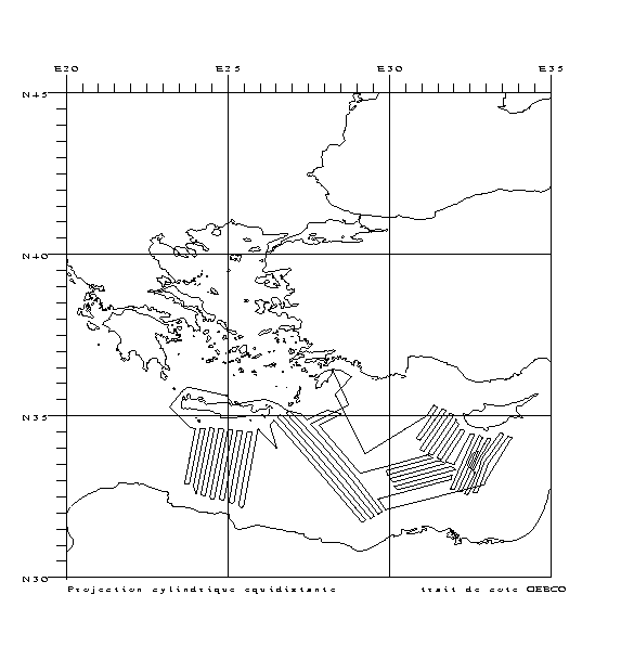
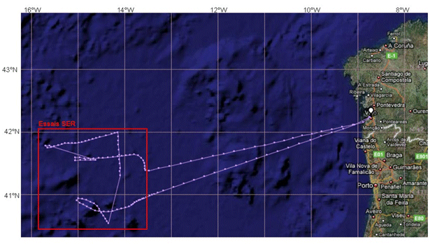
Technological trials run on seismic equipment developed by the SERCEL firm.
-
<p style="text-align:justify">The main objective of the observing system MOOSE is to monitor the long-term evolution of the north-western Mediterranean Sea (over more than 10 years) in the context of climate change and anthropogenic pressure in order to detect and identify the trend and environmental anomalies of the marine ecosystem. The MOOSE network aims to establish an integrated and multidisciplinary system in the Mediterranean Sea in accordance with the objectives of the national MISTRALS program (HyMeX, MeRMEX and ChARMeX). The MOOSE system is supported by national institutes (CNRS-INSU, French Ministry of Higher Education and Research) and involved different partners (Universities, IFREMER, Meteo France).</p> <p style="text-align:justify">The MOOSE network includes "multi-scale" measurement capabilities to accurately document the broad spectrum of hydrodynamic processes already identified (large scale eddies, mesoscale eddies, biogeochemical provinces). High temporal resolution measurements are obtained from fixed observatories (moorings, buoys) but their spatial distribution remains insufficient. Spatial variability is of the same order as temporal variability and understanding the evolution of this basin as a whole implies being able to dissociate both. Synergy with other strategies (ships, floats, gliders) is essential for the establishment of an observation network in such a system. To address the issues identified by MOOSE, two key areas of the north-western basin have been identified:</p> <ul> <li style="text-align:justify">The central and western part of the Ligurian Sea, which constitutes a homogeneous system isolated from direct coastal inputs by rivers and where atmospheric inputs are predominant (DYFAMED and ANTARES). It is also one of the entrance passages of the Intermediate Levantine Water (LIW) in the north-western Mediterranean basin.</li> <li style="text-align:justify">The central area of the Gulf of Lion where winter cooling leads to vertical mixing over 2000 m and sometimes to the bottom. The LION site (42°N 5°E) is ideal for studying the variability of winter convection to better understand mixing processes and dense water formation. It also characterizes the variability of the deep particle flow.</li> </ul> <p style="text-align:justify">Currently, fixed observation at these sites is carried out by six moorings:</p> <ul> <li style="text-align:justify">The Planier and Lacaze-Duthiers moorings composed of sediment traps and T/S sensors and current meters, for dense water cascading and particle export studies. These moorings have been set up since 1994 and managed by CEFREM.</li> <li style="text-align:justify">The LION mooring, consisting of a large number of T/S sensors, current meters, and two oxygen sensors, is in the Gulf of Lion convection zone. It has been deployed since 2007, and is managed by CEFREM and LOCEAN. A sediment trap near the bottom has also been present for 2 years in this area (LIONCEAU mooring). The latter will be integrated into the LION mooring in 2019.</li> <li style="text-align:justify">The ANTARES mooring is located in the North Current off Toulon and equipped with T/S sensors, current meters and oxygen sensors to quantify the bacteria activity and organic matter remineralization process in a deep marine environment. It exists since 2004, it is managed by the M.I.O. and the CPPM (Marseille). This mooring is part of the ERIC EMSO since 2017.</li> <li style="text-align:justify">The DYFAMED mooring, in the Ligurian Sea, equipped with sediment traps, T/S sensors, current meters and oxygen sensors to monitor the evolution of the water column, the impact of atmospheric dust deposition and marine particles export to deep waters. It exists since 1988, it is currently managed by the Oceanological Observatory of Villefranche-sur-Mer. This mooring is part of the ERIC EMSO since 2017.
-
The area in between the Audierne and St. Nazaire canyons (Gascogne) along the Armorican margin was one of the areas where the "massifs coralliens" were described for the very first time. Within the framework of the HERMES (EC FP6), MiCROSYSTEMS (ESF) and GeNeSis (FWO) projects, this area will be surveyed using multibeam and high resolution seismics during LEG 1. Based on this site survey, the ROV Genesis will be deployed to carry out detailed mapping of these deep-water "hot-spots". Also the hydrography and sediment dynamics of this area will be studied with respect to the steering of the present ecosystems. LEG 2 will focus on the Galicia bank. This location has been assigned as reference area within the ESF project BIOFUN. In addition to a bathymetric and seismic surveying, also biological sampling and experiments are planned here.
 Catálogo de datos del IEO