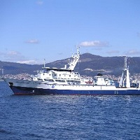
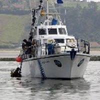
From 1 - 10 / 76
  • Categories    

    CTD data in the Flemish Cap area

  • Categories    

    CTD data in the Flemish Cap area

  • Categories  

    Recogida de datos geofisicos en la plataforma continental hasta los 30m , adyacentes a la zona de Gerona

  • Categories  

    Influence of oceanographic structure and dinamics on DEmersal populations in waters of the BAlearic Islands

  • Categories  

    el estudio de los flujos que entran y salen del mar Balear a traves de los canales de Ibiza y Mallorca y de las condiciones dinamicas del golfo de Valencia y parte sur de Mallorca; y el estudio de la variabilidad estacional de estos flujos, fenomenos de mesoescala y produccion biologica.

  • Categories  

    Monthly survey to study thermohaline and biological characterization of water masses in the East-North Atlantic.

  • Categories  

    Monthly survey to study thermohaline and biological characterization of water masses in the East-North Atlantic.

  • Categories  

    The Algerian continental shelf, very narrow and rocky, is not conducive to bottom trawling. Its average length is 6 km, even in certain areas, the 500-meter isobath is 3 miles from the coast. Only in some gulfs in the west of the country (such as Oran), near the Alboran Sea, the platform reaches an extension above average. According to the Algerian Geographic Unit, it is estimated that only 1/3 of the surface is optimal for bottom trawling: 3,500 km2 up to 200 m depth and 7,000 km2 between 200 and 350 m. This limits the availability of demersal species and thus, rg / 1999 / xhtml "> of the total catches of these species (~ 25,000 Tm), about 4,000 (~ 20%) correspond to crustaceans, mainly prawns, which are caught between 200 and 400 m GOALS Determine the abundance and characteristics of the main demersal resources of Algeria. For this, the following partial objectives are proposed: - Know the biological structure of the communities exploited by the trawl fishery on the platform and the upper slope. - Obtain indices of abundance and biomass of the main species, such as mullet, sparids, hake, monkfish, white shrimp, Norway lobster, pink prawn, Moorish prawns, octopus and cuttlefish. - To determine the characteristics of the demographic structure of these species, as well as to know their geographical and bathymetric distribution. - Collect data on the state of maturity, size and weight, and collect biological samples of demersal species for growth and reproduction studies.

  • Categories  

    The survey in Div. 3NO of NAFO Regulatory Area was initiated by Spain in 1995. Until 2001, the survey was carried out in spring (May), on board the Spanish vessel C/V Playa de Menduiña (338 GT and 800 HP) using bottom trawl net type Pedreira. Since 2001, the R/V Vizconde de Eza replaced the C/V Playa de Menduiña as the research vessel for the survey, and Campelen net replaced Pedreira net as survey gear. The main objectives of this survey time series are: a) to obtain abundance indices of the main exploited species, b) to study the structure and distribution of these demersal species in the area.

  • Categories  

    From day 12 to day 31 of the month of April the B / O Vizconde de Eza made the first of a series of multidisciplinary campaigns aimed at improving knowledge of El Cachucho fishing ground, located on the Asturian marginal shelf within the Spanish EEZ. Morpho-sedimentary study of the "El Cachucho" fishing ground and adjacent area. Dynamics and characteristics of water bodies. Characterization of benthic and demersal communities.