 Catálogo de datos del IEO
Keyword
France
80 record(s)
Type of resources
Categories
Topics
INSPIRE themes
Keywords
Contact for the resource
Provided by
Years
Formats
Status
-
<p style="text-align:justify">The main scientific objectives of the cruises are threefold:</p> <ul> <li style="text-align: justify;">to asses the large scale circulation in the Western Basin, evaluating the water masses and the fluxes at different key point in the basin (The North Current, The East and West Corsica currents, the Balearic front, Algerian Basin). The final goal was numerical modelling assessment.</li> <li style="text-align: justify;">to identify and follow peculiar mesoscale structures such as surface eddies, modal weddies, submesoscale coherent vortices (SCV) meanders or filaments and explore the signature on the sea surface height (altimetry) and the acoustic impact (sound propagation).</li> <li style="text-align: justify;">to observe and interpret the submesoscale dynamics such ageostrophic stirring, symmetric instabilities, mixed layer instabilities, subduction and convection.</li> </ul> <p style="text-align:justify">The <strong>Protevs2015_leg1 </strong>campaign took place from the 8th to 28th of January 2015 on board of the RV <em>Pourquoi Pas?</em> in the north western mediterranean basin. It is focused on physical aspects (hydrology and dynamics). The main objective was the dynamics of the North current from its roots in the Ligurian Sea downstream to the Gulf of Lion. The surveys try to catch not only the meso-scale features but also the submesoscale associated to the the northern current or at least in its vicinity.</p> <p style="text-align:justify"> </p> <p style="text-align:justify"> </p>
-
<p style="text-align:justify">SHOM cruise with implementation of the MVP.</p>
-
<p>The WESTMEDFLUX-2 oceanographic cruise is part of the project that studies the presence of thermal anomalies in the ocean-continent transitions of the Western Mediterranean. The proposed cruise follows WESTMEDFLUX that took place in 2016 and that resulted in mapping regional trends of thermicity in in the Gulf of Lion, offshore Baleares and Sardinia. It also pointed out to the existence of several local heat flow anomalies in particular on the South Balearic slope and deep basin. In the deep oceanic basin, strong anomalies seem to be merely associated to salt diapiric structures, but on the rifted continent and transition zone, other heat sink and sources are suggested (e.g., bottom water currents, slope instabilities and focused fluid migrations). In order to better understand the source of these anomalies and the link with the crustal nature and structuring of the margin, we propose on the South-Balearic margin additional close-spaced heat flow measurement, sediment coring and dredging sites. Sediment cores will be used for turbidite and contourite studies and for geochemical analysis of pore fluids. The dredging operations aim an estimation of age and nature of volcanic rock material from sea mounts.</p>
-
<p>Sea recovery of all components of a stratospheric balloon: balloon envelope, parachutes, and gondolas. Test of new gamma detectors and characterization of solar panels for the Strateole project. There has been no work done at sea after balloon fly. The balloon flight took place. The climb path was consistent with the expected. However the ceiling track was a little south and a little slower than expected. The ball has arrived above the sea but too south. Down a bit low, he found the westerly winds that brought him back to earth. Separating late flight and recovery have made campaigning in the Basque country.</p>
-
Charter cruise with the objective of validating the performance of SERCEL equipment, i.e. evaluation of different seismic devices and validating this equipment.
-
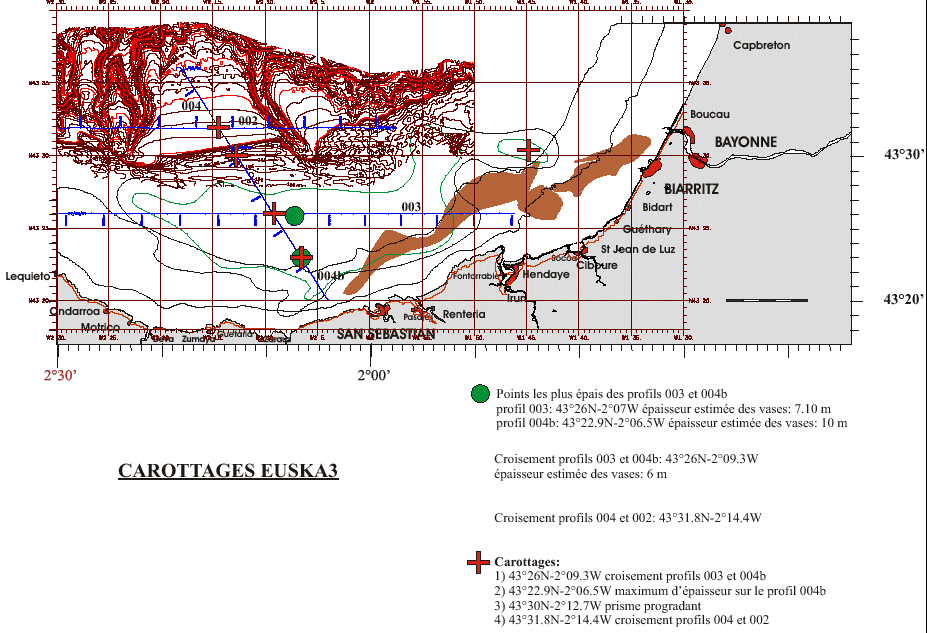
Core sampling on the mudflat of the Basque continental shelf. This falls under the Aquitaine / Euskadi project.
-
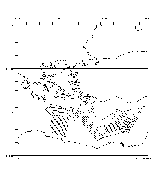
Characterizing the variability of hydrological and current features and particulate fluxes on the continental rise of the Gulf of Lion and in the deep convection zone. Monitoring of deep benthic communities in the western canyons and on the continental rise of the Gulf of Lion. This cruise was associated with the HERMES and EXTREMA projects.
-
The main objective of the MOOSE-GE cruises is to observe the annual evolution of the Northwestern Mediterranean Sea in the context of the climate change and anthropogenic pressure in order to be able to detect and identify long-term environmental trend and anomalies of the marine ecosystem. The annual cruise focuses on moorings maintenance and hydrology, biogeochemistry and biology monitoring of the Northwestern Mediterranean basin. It aims to follow variability of water masses properties (LIW and WMDW) and biogeochemical and biological content related to these water masses. BILLION 36 cruise was part of this cruise too.
-
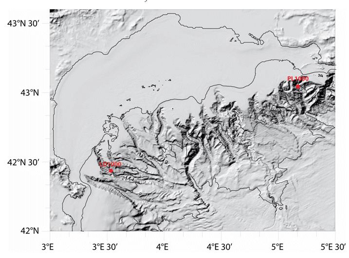
Characterizing the variability of hydrological and current measurement features and particulate fluxes in two canyons of Le Planier (station PL1000) and Lacaze-Duthiers (station LD1000) located at the easternmost and westernmost tips of the Gulf of Lion.
-
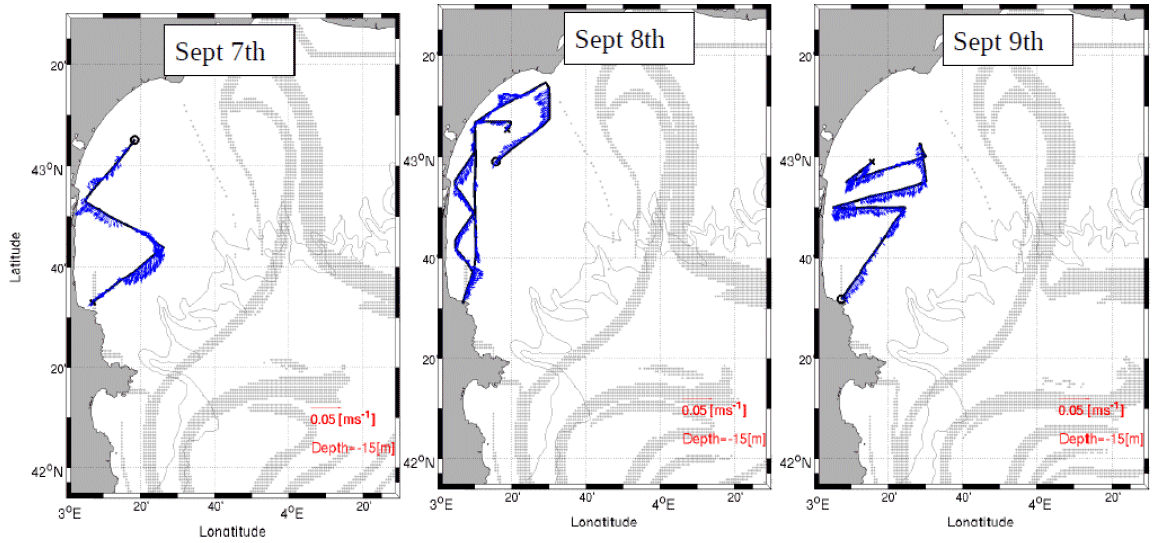
Understanding the role played by the combined physical-biogeochemical dynamics at (sub)-mesoscales in exchanges of matter and energy between coastal and open sea areas. The LATEX strategy is based on selective and combined use of numerical modelling and in situ observations (Lagrangian floats, SF6, shipboard ADCPs, ADCP moorings, satellite images, gliders and coastal radars). The main objective of LATEX is to study the impact of an eddy structure at (sub)mesoscale, which is chronically present in the western part of the Gulf of Lion, in interaction with the North Mediterranean current(NMC)on trends in the distribution of conservative tracers and biogeochemical properties. Thanks to this strategy, LATEX should provide answers to the following questions: - Is this type of structure likely to significantly affect the horizontal transfer of matter between the continental shelf and the NMC? - What are the consequences for biogeochemical cycles of the structure's interaction with the NMC? - How do CO2 concentrations evolve within the eddy throughout its life cycle? - How does this type of (sub)-mesoscale coastal eddy act in structuring of plankton communities and the variability in primary production observed in the study zone? - Are the amounts of matter transferred by (sub)-mesoscale structures significant with respect to that displaced by the general circulation on seasonal and annual scales? The related project is called LATEX (LAgrangian Transport Experiment).