 Catálogo de datos del IEO
Keyword
Brest
25 record(s)
Type of resources
Categories
Topics
INSPIRE themes
Keywords
Contact for the resource
Provided by
Years
Formats
Status
-
Retrieving an array of moored current meters recording subtidal circulation on the ocean margins of the Bay of Biscay (Armorican and Aquitaine shelves and slopes). Related hydrological measurements taken. This falls under the ASPEX project.
-
Hydrography and physical oceanography cruise for the French Navy's hydrographic and oceanographic service (SHOM).
-
SHOM cruise .
-
SHOM cruise
-
<p>The Protevs Swot 2018 campaign aimed to explore the South Balearic zone in early spring to observe the small scales of the oceanic mixed layer using high-resolution sampling devices.</p> <p>The area was chosen because it was positioned below the SWOT satellite's planned swath in its validation/calibration period. In this sense, it is a precursor experiment of experiments for the year 2022 and as such exploratory of the scales that will be observable by this newly designed altimetry satellite.</p> <p>A particular focus was placed on an anticyclonic structure in the southern Balearic Islands that is systematically detectable by altimetry but which appears to be an artifact.</p> <p>These samplings were combined with fine analysis of the surface content of small phytoplankton by flow cytometry to study the shaping of the marine landscape by frontal physical processes.</p> <p> </p>
-
SHOM oceanographic cruise
-
SHOM cruise between Brest and Lisbon
-
FWO MINIMOUND Project: Using Cold-water coral mini-mounds as analogue for giant mound growth: assessment of environmental drivers and anthropogenic impact Cold-water corals (CWC) are found along the entire north-eastern Atlantic Margin from Norway to the Gulf of Cadiz. In the Porcupine Seabight, these coral reefs (mainly Lophelia pertusa and Madrepora oculata) accumulate into large mounds of up to 250m high (e.g. Challenger Mound), which have been well studied over the past two decades (Roberts et al., 2006). The detailed mechanism of the start-up phase of such large CWC mounds is however not yet fully understood. Therefore, it is essential to study analogues of these stages that are not well recorded in larger mounds. The FWO MINIMOUND project (2013-2016) aims to investigate the initiation, growth and demise of small CWC mounds and to determine the role of climatic and hydrocarbon-seepage related processes as well as anthropogenic impact. This high-resolution multidisciplinary study will focus on three minimound provinces along the Biscay continental margin: (1) the Explorer and Dangeard Canyons on the Celtic Margin (Fig. 1; Stewart et al., 2013), (2) the Guilvinec Canyon on the Armorican Margin (De Mol et al., 2011) and (3) the Upper Ferrol Canyon on the Cantabrian Margin (Fig. 1). These minimounds are fossil (9.7 ka BP) and occur at relative shallow depth on the interface between the Eastern North Atlantic Central Water (ENACW) and the Mediterranean Outflow Water (MOW). Contrastingly, most present-day living CWC reef habitats dwell in the deeper MOW depth range, relying on the density and dynamics of this water mass for their food supply.   The objectives of the project are threefold: (1) the establishment of a chronostratigraphic framework and the reconstruction of palaeoceanographic changes over the last 15.000 years in order to determine the impact of glacial to interglacial climate change on the ENACW-MOW interface and the CWC habitats (Frank et al., 2011); (2) the minimound province at the Upper Ferrol Canyon shows a close association with hydrocarbon-seepage (pockmarks) which allows to assess the role of hydrocarbon related processes in CWC mound formation; (3) the potential impact of anthropogenic fisheries activities will be investigated. These objectives will be tackled through a coupled geophysical, sedimentological and integrative approach, including the palaeoceanographic and biogeochemical study of sediment cores in cooperation with the BGS (UK), LSCE (Gif-sur-Yvette, France), IFREMER (France), IGME (Spain) and IEO (Spain). This Belgica2015/15 cruise is the second campaign of the project and it aims to sample both on-mound as off-mound sites by means of a 4.5 m vibrocorer (Supplied by the British Geological Survey, BGS). The target site are located on the upper slopes of the Ferrol Canyon (Cantabrian margin, Spanish EEZ) and the Guilvinec Canyon (Armorican margin, French EEZ) between 200 and 600 m water depth. In each sector, a minimum of 3 days of activities will be scheduled. In case of bad weather on 1 sector, the program will be revised towards the other sector. With respect to the size of these mounds, the coring location of the vibrocorer will be steered by means of am IXSEA USBL GAPS system. During night-time, the seafloor will be visually characterized using a small and light-weight camera dropframe (University of Plymouth).
-
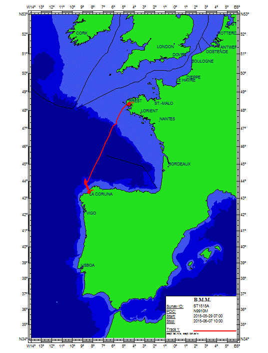
SHOM cruise between Brest and Vigo
-
? Estimation of the abundance of small pelagic fishes, with special focus on anchovy juveniles, in the southern part of the Bay of Biscay.\n? Cartography of the distribution of these populations.\n? Study of the distribution of anchovy and sardine eggs.\n? Biological sampling of the species of interest (e.g. ). Particularly for anchovy, analysis of stomach contents for the characterisation of the food regime and of otholits for the study of daily growth rates.\n? Continuous sampling of auxiliary variables for the characterisation of the ambient environment.\n? Study of the hydrographic conditions and distribution of plankton components in order to define the physical and biological processes which are relevant for the regulation of the species of interest.