 Catálogo de datos del IEO
Category
Campañas extranjeras
130 record(s)
Type of resources
Categories
Topics
INSPIRE themes
Keywords
Contact for the resource
Provided by
Years
Formats
Status
-
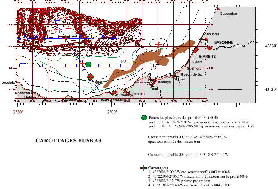
Core sampling on the mudflat of the Basque continental shelf. This falls under the Aquitaine / Euskadi project.
-
Campaign GENESIS 2 "Pen Duick/Melilla", the second of three ROV campaigns, will focus on "Pen Duick Escarpment" in the Gulf of Cadiz or on the recently discovered "Melilla mounds" in the South-East Alboran Sea (Mediterranean Sea). The final choice of the study area will depend on the results of the TTR17 cruise with R/V Logachev (June-July 2008) and the R/V Marion Dufresne cruise (June 2008). One of these study areas will be surveyed using multibeam, side-scan sonar and high resolution seismics. Based on this site survey, the ROV Genesis will be deployed to carry out detailed mapping. Also the hydrography and sediment dynamics of the area will be studied with respect to the steering of the present ecosystems. GENESIS 2 takes place in the framework of the European projects HERMES (EC FP6), MiCROSYSTEMS (ESF) and HERMIONE (EC FP7).
-
SHOM cruise aboard the Pourquoi Pas?
-
SHOM oceanographic cruise
-
CTD stations on 20W line from 50N to 20N, following the old WOCE line A16N Physical measurements (CTDO and LADCP) and discrete samples for salt, oxygen, inorganic nutrients and alkalinity/inorganic carbon Underway ADCP, surface ocean measurements, surface meteorology measurements. Contribution to GO-SHIP sustained hydrography program. Partial repeat of a hydrographic line last occupied in 2003.
-
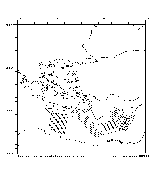
Characterizing the variability of hydrological and current features and particulate fluxes on the continental rise of the Gulf of Lion and in the deep convection zone. Monitoring of deep benthic communities in the western canyons and on the continental rise of the Gulf of Lion. This cruise was associated with the HERMES and EXTREMA projects.
-
The three key objectives of our original proposal were to test: 1. The hypothesis that mantle upwelling and melting is focused at the centres of slow spreading ridge segments and transposed by sub-horizontal flow away from there. 2. The hypothesis that plate accretion and separation mechanisms are fundamentally different in 'magma-starved' areas. 3. Mechanisms of detachment faulting and extensional strain localisation in the lower crust and upper mantle. We proposed to achieve these objectives by detailed surveying and sampling across an extensive region of magma-poor seafloor spreading around Fifteen Twenty Fracture Zone (FTFZ), coupled with microstructural, geochemical and palaeomagnetic analyses. TOBI deep-towed sidescan and magnetic data were to be obtained both to inform the choice of sampling sites and to aid in structural, lithological and geodynamic interpretations. We spent 29 days on the Mid-Atlantic Ridge (MAR) in the vicinity of 13 to 15N. We collected multibeam ship-based bathymetry, gravity and magnetic data and TOBI sidescan, magnetic and water-column data from a total area of about 8,000 km2. We recovered samples from 47 drill and dredge stations throughout the area, in support of the objectives.
-
Transit.
-
The main objective of the MOOSE-GE cruises is to observe the annual evolution of the Northwestern Mediterranean Sea in the context of the climate change and anthropogenic pressure in order to be able to detect and identify long-term environmental trend and anomalies of the marine ecosystem. The annual cruise focuses on moorings maintenance and hydrology, biogeochemistry and biology monitoring of the Northwestern Mediterranean basin. It aims to follow variability of water masses properties (LIW and WMDW) and biogeochemical and biological content related to these water masses. BILLION 36 cruise was part of this cruise too.
-
<p style="margin-left:0cm; margin-right:0cm">The objective of the campaign PELMED is to estimate the biomasses of small pelagic fish of the Gulf of Lion by acoustic method and to collect a maximum of parameters at each level of the trophic chain. This approach aims towards a more and more ecosystematic campaign(countryside), what is in adequacy with the Directive Centre Strategy for the Marine environment (DCSMM) and the objectives of the UMR MARBEC.</p>