Keyword
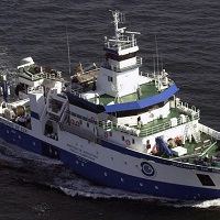
Vizconde de Eza
138 record(s)
Type of resources
Categories
Topics
INSPIRE themes
Keywords
Contact for the resource
Provided by
Years
Formats
Status
-

Study of the impact of the fishing fleet on vulnerable ecosystems in the area of the Hatton Bank.
-

Abundance indices, distribution patterns and faunal assemblages of demersal species in the Porcupine bank, together with the possible driving factors of their distribution. This survey belongs to the research project: ?Evaluacion de Recursos Demersales por Metodos Directos en el Area ICES?. This Project is partly funded by the DCR of the EU and the Education and Science Spanish Ministery.The main objectives of the above mentioned project related with this survey time series are: a) to obtain abundance indices of the main exploited species in the Porcupine bank; b) to estimate the strength of yearly recruitments of these species and their distribution in the bank. c) to study the structure and distribution o the demersal and benthic communities in the area.
-

Abundance indices, distribution patterns and faunal assemblages of demersal species in the Porcupine bank, together with the possible driving factors of their distribution. This survey belongs to the research project: 'Evaluación de Recursos Demersales por Métodos Directos en el Área ICES'. This Project is partly funded by the DCR of the EU and the Science and Innovation Spanish Ministry.The main objectives of the above mentioned project related with this survey time series are: a) to obtain abundance indices of the main exploited species in the Porcupine bank; b) to estimate the strength of yearly recruitments of these species and their distribution in the bank. c) to study the structure and distribution o the demersal and benthic communities in the area.
-

La creciente necesidad de informacion que requiere la evaluacion y gestion actuales de las especies explotadas, especialmente en el caso de la merluza, pero tambien en otros como los gallos, rapes o la cigala, hacen necesario obtener informacion independiente de las pesquerias sobre la situacion de estas poblaciones. Para lo cual se determino la realizacion de los siguientes objetivos:\nEstimacion de indices de abundancia estratificados por edad de merluza, rapes y gallos en las divisiones VIIbk.\nEstimacion de indices de abundancia estratificados de otras especies comerciales como la cigala, el mendo, las rayas o la brotola.\nEstimacion de la fuerza de los reclutamientos y localizacion de las agregaciones de juveniles de merluza, rapes y gallos.\nDescripcion de los patrones de distribucion espacial de las especies demersales y bentonicas en el banco de Porcupine.\nRecogida de material para estudios de contaminacion por metales pesados.\nRecogida de material para estudios geneticos.
-

The survey in Div. 3NO of NAFO Regulatory Area was initiated by Spain in 1995. Until 2001, the survey was carried out in spring (May), on board the Spanish vessel C/V Playa de Menduiña (338 GT and 800 HP) using bottom trawl net type Pedreira. Since 2001, the R/V Vizconde de Eza replaced the C/V Playa de Menduiña as the research vessel for the survey, and Campelen net replaced Pedreira net as survey gear. The main objectives of this survey time series are: a) to obtain abundance indices of the main exploited species, b) to study the structure and distribution of these demersal species in the area.
-

- Informacion en tiempo real de las estructuras de temperatura y salinidad de las capas superiores e intermedias de los oceanos.\n- Variabilidad de masas de aguas y calculos de transportes.Gyroscope
-

Abundance indices, distribution patterns and faunal assemblages of demersal species in the Flemish Cap bank, together with the possible driving factors of their distribution. This survey belongs to the research project: 'Biología Pesquera pesquerías Lejanas'. This Project is partly funded by the DCR of the EU and the Education and Science Spanish Ministery.The main objectives of the above mentioned project related with this survey time series are: a) to obtain abundance indices of the main exploited species in the Flemish Cap bank; b) to estimate the strength of yearly recruitments of these species and their distribution in the bank. c) to study the structure and distribution o the demersal and benthic communities in the area.
-

Study of the impact of the 'bowling train' fishing modality on the seabed of the Cantabrian Sea.
-

Survey belong to the bathymetric studies of Canary Islands
-

- LEVANTAMIENTO MORFOLOGICO DETALLADO DEL FONDO MARINO, MEDIANTE UN RECONOCIMIENTO DE LAS ZONAS DE ESTUDIO REALIZADO CON ECOSONDA MAULTIHAZ\n- CONOCIMIENTO DE LAS CARACTERISTICAS SEDIMENTARIAS DEL SUELO Y SUBSUELO MARINO MEDIANTE LA REALIZACION DE PERFILES SISMICOS DE ALTA RESOLUCIONCON EL SISTEMA DE SONDA PARAMETRICA TOPAS\n- PROSPECCION DE POSIBLES RESTOS DE POSIBLES RESTOS DE FUEL ENTRE DOS AGUAS MEDIANTE ECOSONDA HIDROGRAFICA\n- IDENTIFICACION Y MAPEADO DE AREAS DE DEPOSICION DE FUEL MEDIANTE EL RECONOCIMIENTO DEL AREA DE ESTUDIO CON SONAR DE BARRIDOLATERAL CON PRESTACIONES DE ALTA FRECUENCIA, MAYOR RESOLUCION Y MOSAICOS DE REFLECTIVIDAD OBTENIDOS CON ECOSONDA MULTIHAZ\n- RECOGIDA DE MUESTRAS DE ROCA Y SEDIMENTOS DE FUEL UTILIZANDO PARA ELLO DRAGA DE ROCA\n- TOMA DE DATOS
 Catálogo de datos del IEO