Keyword
Date and time
281 record(s)
Type of resources
Categories
Topics
INSPIRE themes
Keywords
Contact for the resource
Provided by
Years
Formats
Status
-

Exploration of deep-sea fisheries in the fishing grounds of Namibia
-

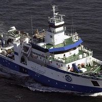
From day 6 to day 21 of the month of October the B / O Vizconde de Eza made the first of a series of multidisciplinary campaigns aimed at improving knowledge of El Cachucho fishing ground, located on the Asturian marginal shelf within the Spanish EEZ. This fishing ground is characterized by being a very irregular zone, presenting slopes greater than 45 degrees in some areas. The study of benthic communities and demersal fish was supported by exhaustive studies of other disciplines in order to obtain information about their environment and existing trophic relationships. The results obtained, and analyzed separately, of each discipline are of great value due to the unique characteristics of the fishing ground, but the common effort of the participants to relate all the subjects adds to the campaign an incalculable value in the scientific field and unique knowledge for the management of the fishery in the current framework that advocates sustainable development. GOALS Due to the scarce bathymetric information in the fishing grounds, the first part of the campaign focused on obtaining an accurate bathymetry of the study area that served as the basis for the physical, chemical, geological and biological studies that the different participating teams carried out. then. WORK AREA Image of the work area comprising the upper part of the Le Danois bank and the area between this elevation and the Lastres canyon The bank's funds are difficult to access, due to their depth and relief, for most of the instruments that come into contact. This limits the area of the study area. Mainly the works were oriented to the upper part of the bank Le Danois and to the area between this elevation and the Lastres
-

Exploration of deep-sea fisheries in the fishing grounds of Morocco, within the framework of cooperation between the Kingdom of Morocco and the Ministry of Agriculture, Fisheries and Food.
-

This campaign to evaluate deep demersal resources on the coasts of Algeria responds to the need to update and expand the studies and evaluations carried out in the 1980s. During this fishing prospecting campaign, 55 catches were made between 200 and 800 meters deep, using bottom trawls. To determine the abundance and properties of the main fishing resources of Algeria, it was necessary to obtain prior knowledge of the characteristics of the seabed on the sampled fishing beaches. Likewise, the precise knowledge of the bathymetry and morphology of the bottom optimized the trawl work and, in short, the achievement of the fishing campaign. GOALS Image of ship's personnel releasing trawl - Bathymetric and morphological recognition of the seabed in the upper slope and the Algerian coast. - Know the biological structure of demersal communities subjected to exploitation in the upper and middle slope of the study area. - Obtain indices of abundance and biomass of the main deep demersal species (hake, monkfish, white prawn, Norway lobster and red shrimp). - Characterize the demographic structure of the main demersal species exploited on the slope, as well as its geographical and bathymetric distribution. - Collect data and collect samples (otoliths) from deep demersal species for growth and reproduction studies. WORK AREA The bathymetric surveys were carried out at night, in such a way that sufficient time was available to elaborate the bathymetric maps and digital terrain models. This allowed the selection of the haul zones and served as an electronic cartography for navigation.
-

The Algerian continental shelf, very narrow and rocky, is not conducive to bottom trawling. Its average length is 6 km, even in certain areas, the 500-meter isobath is 3 miles from the coast. Only in some gulfs in the west of the country (such as Oran), near the Alboran Sea, the platform reaches an extension above average. According to the Algerian Geographic Unit, it is estimated that only 1/3 of the surface is optimal for bottom trawling: 3,500 km2 up to 200 m depth and 7,000 km2 between 200 and 350 m. This limits the availability of demersal species and thus, rg / 1999 / xhtml "> of the total catches of these species (~ 25,000 Tm), about 4,000 (~ 20%) correspond to crustaceans, mainly prawns, which are caught between 200 and 400 m GOALS Determine the abundance and characteristics of the main demersal resources of Algeria. For this, the following partial objectives are proposed: - Know the biological structure of the communities exploited by the trawl fishery on the platform and the upper slope. - Obtain indices of abundance and biomass of the main species, such as mullet, sparids, hake, monkfish, white shrimp, Norway lobster, pink prawn, Moorish prawns, octopus and cuttlefish. - To determine the characteristics of the demographic structure of these species, as well as to know their geographical and bathymetric distribution. - Collect data on the state of maturity, size and weight, and collect biological samples of demersal species for growth and reproduction studies.
-

Exploration of deep-sea fisheries in the fishing grounds of Morocco, within the framework of cooperation between the Kingdom of Morocco and the Ministry of Agriculture, Fisheries and Food.
-

Within the framework of cooperation between the Ministry of Agriculture, Fisheries and Food (MAPA) and the Ministry of Fisheries of the Republic of Angola, the campaign to evaluate the main species of crustaceans and other demersal resources of existing fishing interest was undertaken on the platform and slope of the Exclusive Economic Zone of the Republic of Angola. WORK AREA The investigation was developed in the area of the platform and the slope of the Exclusive Economic Zone of the Republic of Angola between the parallels 5º S and 12º S, from 12 miles from the coast, counted from the baseline, to the Isobot of the 800 meters deep.
-

Exploration of deep-sea fisheries in the fishing grounds of Morocco, within the framework of cooperation between the Kingdom of Morocco and the Ministry of Agriculture, Fisheries and Food.
-

Study and analysis of parameters such as sea temperature, salinity, dissolved oxygen, nitrate, phosphorusand chlorophyll and phytoplancton
-

From day 12 to day 31 of the month of April the B / O Vizconde de Eza made the first of a series of multidisciplinary campaigns aimed at improving knowledge of El Cachucho fishing ground, located on the Asturian marginal shelf within the Spanish EEZ. Morpho-sedimentary study of the "El Cachucho" fishing ground and adjacent area. Dynamics and characteristics of water bodies. Characterization of benthic and demersal communities.
 Catálogo de datos del IEO