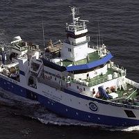
Campaña: ARGELIA 0204
The Algerian continental shelf, very narrow and rocky, is not conducive to bottom trawling. Its average length is 6 km, even in certain areas, the 500-meter isobath is 3 miles from the coast. Only in some gulfs in the west of the country (such as Oran), near the Alboran Sea, the platform reaches an extension above average. According to the Algerian Geographic Unit, it is estimated that only 1/3 of the surface is optimal for bottom trawling: 3,500 km2 up to 200 m depth and 7,000 km2 between 200 and 350 m. This limits the availability of demersal species and thus, rg / 1999 / xhtml "> of the total catches of these species (~ 25,000 Tm), about 4,000 (~ 20%) correspond to crustaceans, mainly prawns, which are caught between 200 and 400 m GOALS Determine the abundance and characteristics of the main demersal resources of Algeria. For this, the following partial objectives are proposed: - Know the biological structure of the communities exploited by the trawl fishery on the platform and the upper slope. - Obtain indices of abundance and biomass of the main species, such as mullet, sparids, hake, monkfish, white shrimp, Norway lobster, pink prawn, Moorish prawns, octopus and cuttlefish. - To determine the characteristics of the demographic structure of these species, as well as to know their geographical and bathymetric distribution. - Collect data on the state of maturity, size and weight, and collect biological samples of demersal species for growth and reproduction studies.
|
|
. Campaña: ARGELIA 0204. http://datos.ieo.es/geonetwork/srv/api/records/urn:SDN:CSR:LOCAL:29VE200402050 |
Simple
- Título alternativo
- Referencia IEO: 29VE200402050
- Fecha ( Creación )
- 2004-03-16
- Identificador
- urn:SDN:CSR:LOCAL:29VE200402050
Orígen
IEO/ Balearic Islands Oceanographic Centre
IEO/ Balearic Islands Oceanographic Centre
Muelle de Poniente, s/n Apdo. 291
Palma de Mallorca (Baleares)
07015
Spain
- Estado
- Terminado
Punto de Contacto
IEO/ Balearic Islands Oceanographic Centre
-
Enric Massutí
Muelle de Poniente, s/n Apdo. 291
Palma de Mallorca (Baleares)
07015
Spain
- GEMET - INSPIRE themes, version 1.0 ( Tema )
-
- Oceanographic geographical features
- SeaDataNet Ports Gazetteer ( departure_place )
-
- Palma de Mallorca
- SeaDataNet Ports Gazetteer ( arrival_place )
-
- Palma de Mallorca
- International Standards Organisation countries ( departure_country )
-
- Spain
- International Standards Organisation countries ( arrival_country )
-
- Spain
- ICES Platform Codes ( platform )
-
- Vizconde de Eza
- SeaVoX Platform Categories ( platform_class )
-
- research vessel
- SeaVoX salt and fresh water body gazetteer ( Lugar )
-
- Mediterranean Sea, Western Basin
- Ten-degree Marsden Squares ( marsden_square )
-
- 144
- SeaDataNet Parameter Discovery Vocabulary ( parameter )
-
- Biodiversity indices
- Date and time
- Fish abundance in water bodies
- Fish biomass in water bodies
- Fish non taxonomy-related abundance per unit volume of the water column
- SeaDataNet device categories ( instrument )
-
- pelagic trawl nets
- Limitación de uso
- Not applicable
- Restricciones de Acceso
- Restricted
- Otras limitaciones
- Tipo de representación espacial
- Vector
- Idioma del metadato
- Spanish; Castilian
- Codificación
- utf8 UTF8
- Categoría temática
-
- Océanos
N
S
E
W
))
- Fecha de inicio
- 2004-02-05T00:00:00
- Fecha de finalización
- 2004-03-16T00:00:00
- Formato de la distribución
-
- XML (1 )
- Recurso en línea
-
Base de datos internacional con información de campañas desde 1873 hasta la actualidad. La presente campaña la podrás encontrar como ARGELIA 0204.
SeaDataNet - CRS inventory
- Recurso en línea
-
Descubre si hay datos de esta campaña disponibles, utilizando para ello la etiqueta ARGELIA 0204 en el buscador de datos de SeaDataNet.
SeaDataNet - CDI inventory
- Jerarquía
- Campaña/Survey Campañas
Conformidad del Resultado
- Fecha ( Publicación )
- 2010-12-08
- Explicación
- See the referenced specification
- Aprobado
- true
- Declaración
- El Centro de datos aplica controles de calidad estandarizados a todos los datos de los que es responsable. Contacta con el Centro de datos para más información.
gmd:MD_Metadata
- Identificador del fichero
- urn:SDN:CSR:LOCAL:29VE200402050 XML
- Idioma del metadato
- Spanish; Castilian
- Codificación
- utf8 UTF8
- Jerarquía
- Campaña/Survey Campañas
- Nombre del nivel de jerarquía
- Cruise Summary record
- Fecha
- 2018-06-19
- Nombre estándar del metadato
- ISO 19115/SeaDataNet profile
- Versión estándar del metadato
- 1.0
Punto de Contacto
Instituto Español de Oceanografía
IEO/Spanish Oceanographic Institute
Corazon de Maria, 8
MADRID
28002
Spain
 Catálogo de datos del IEO


