 Catálogo de datos del IEO
Keyword
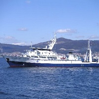
Cornide de Saavedra
189 record(s)
Type of resources
Categories
Topics
INSPIRE themes
Keywords
Contact for the resource
Provided by
Years
Formats
Status
-
IEO 0574
-
Cr. MPH-SARACUS 0488 - ref 303
-
Mejorar el conocimiento de la Hidrografia, circulacion costera de la plataforma continental N-NW de la Peninsula Iberica.\nConocimiento de la abundancia y condicion de las larvas de cupleidos.\nRelacion entre condiciones oceanograficas y supervivencia de las larvas
-
1.- Estimacion de los indices de abundancia (numero y biomasa), de las especies demersales de mayor interes pesquero, asi como de la fauna asociada a ellas. 2.- Determinacion de la distribucion geografica y batimetrica de las diferentes especies. 3.- Obtencion de las distribuciones de tallas de peces, de las capturas asi como de los crustaceos y moluscos de interes pesquero. 4.- Extraccion de otolitos de merluza. 5.- Obtencion de datos biologicos de las principales especies comerciales: estados de madurez, proporcion de sexos 6.- Obtención de datos oceanograficos.
-
Caracterizacion fisica, biogeoquimica y de produccion planctonica Estudio de los frentes costeros que delimitan los ambientes.
-
The MEDITS survey (International bottom trawl survey in the Mediterranean is organized to monitor the demersal resources in the Mediterranean. It intends to produce relevant information to support the fishery policy by collecting abundance data and biological parameters of fish, crustaceans and cephalopods species. The hauls are positioned following a depth stratified sampling scheme with random drawing of the positions within each stratum. The hauls are made in the same position from year to year. The following depths are fixed in all areas as strata limits : 10 - 50 m, 50 - 100 m, 100 - 200 m, 200 - 500 m, 500 - 800 m. The protocols, including the specifications of the standard gear are described in an instruction manual. The series began in 1994 with one yearly survey. Ten Mediterranean countries are applying the Medits protocols (about 1100 hauls per year).
-
Thermohaline and Biochemical characterization in tree standard transects belonging to Galician-Cantabric Sea waters: Finisterre, Ortegal and Cabo Mayor (Santander), covering the whole water column in every single station.
-
The objectives of this cruise are framed on the project "Radial Profunda de Canarias (RAPROCAN-II)". This Project is funded by the Instituto Español de Oceanografía and the main scientific objectives are: a)Characterize the different ways of variability of heat and mass transport at the eastern end of the subtropical gyre. b)Determine the structure of current that reaches the Canary Islands, their mass transport, heat and nutrients and their interannual variability. c)Determine the correlation between heat and mass transport with the atmospheric and oceanic NAO index. d)Characterize the annual cycle in the physical condition of the surface and mixed layers as far as the seasonal cycle is significant, relating to meteorological forcing. e)Characterize of changes in water masses, mainly in the North Atlantic Central Water (NACW), Intermediate Water (AAIW), Mediterranean Water (MW) and bottom water of the Canary basin, studying their characteristics of temperature, salinity, nutrients and oxygen.
-
Oceanographic survey collected in the framework of the PESCADIZ and STOCA projects. PESCADIZ is funded by the Instituto Español de Oceanografía / DCRP and the main scientific objective is to produce an index and a direct estimate of the biomass of demersal target species in the Gulf of Cádiz together with the hydrographic caracterization at the time of the cruise. STOCA is a program conducting systematic hydrographic and plankton observations along three standard sections in the eastern Gulf of Cadiz.
-
Oceanographic survey collected in the framework of the following research project: ?Metodos de Produccion de Huevos. Estimacion de la biomasa de especies pelagicas de interes comercial: sardina, anchoa, caballa y jurel (ICTIOEVA)?. This Project is funded by the Instituto Espa?ol de Oceanografia and the main scientific objective is to produce an index and a direct estimate of the biomass of the Northeast Atlantic mackerel stock and the southern and western horse mackerel stocks using the Annual Egg Production Method (AEPM). Specific aims:a) To estimate the spawning area distribution of mackerel and horse mackerel and the daily and total mackerel and horse mackerel egg production. b) To collect adults to obtain mackerel and horse mackerel gonads for atresia and fecundity estimation c) Distribution and abundance of other commercial species of interest: sardine, anchovy, hake, blue whiting.d) To describe the oceanographic and meteorological character of the area of study with the aim of relating environmental conditions (temperature, salinity, currents) with the spatial distribution of the ichthyoplankton