 Catálogo de datos del IEO
Keyword
current meters
148 record(s)
Type of resources
Categories
Topics
INSPIRE themes
Keywords
Contact for the resource
Provided by
Years
Formats
Status
-
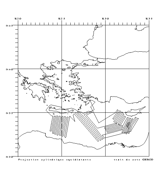
Characterizing the variability of hydrological and current features and particulate fluxes on the continental rise of the Gulf of Lion and in the deep convection zone. Monitoring of deep benthic communities in the western canyons and on the continental rise of the Gulf of Lion. This cruise was associated with the HERMES and EXTREMA projects.
-
Retrieving an array of moored current meters recording subtidal circulation on the ocean margins of the Bay of Biscay (Armorican and Aquitaine shelves and slopes). Related hydrological measurements taken. This falls under the ASPEX project.
-
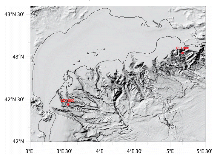
Characterizing the variability of hydrological and current measurement features and particulate fluxes in two canyons of Le Planier (station PL1000) and Lacaze-Duthiers (station LD1000) located at the easternmost and westernmost tips of the Gulf of Lion.
-

This campaign is part of the experimental work that has been carried out in this area since 1996, as part of the CANIGO international and multidisciplinary project (financed by the European Union), as well as the FONDEBC project (financed by the IEO) and now part of the project CORICA approved by the National R + D + I Program in December 2001. The main objective of the subproject is to study, define, measure and model the movements of the water masses that are present in the eastern part of the subtropical turn of the North Atlantic, with special detail in the northward current of the Antarctic Intermediate Water (AAIW) and its interaction with Mediterranean Water (MW), to assess its importance in the transport of energy within the global climate. Goals:Due to incidents in the Gyroscope Campaign, the restructuring of the campaign plan that best suited itself was determined. The main objective was the funding of two series of current meters for the continuous hydrographic study of currents in a specific area of the Canary archipelago.
-
<p>Understanding the ecosystems of hydrothermal sites and their surrounding areas in the Atlantic: mapping and characterization of the geological and geochemical context, characterization of habitats, inventory of biodiversity in hydrothermal ecosystems and surrounding areas and geobiological connectivity and interaction.</p>
-
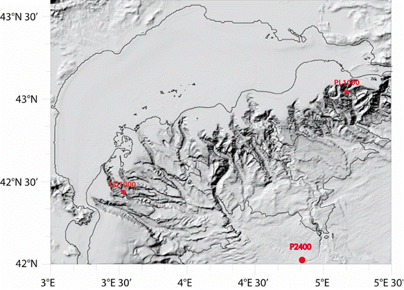
Characterizing the variability of hydrological and current measurement features and particulate fluxes in two canyons of Le Planier (station PL1000) and Lacaze-Duthiers (station LD1000) located at the easternmost and westernmost tips of the Gulf of Lion. Since 2011, setting up a long-term frame of reference in the convection zone - PPS3 trap, buoy zone and LION line.
-
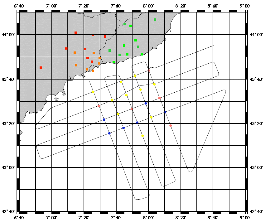
The main objective of the MOOSE-GE cruises is to observe the annual evolution of the Northwestern Mediterranean Sea in the context of the climate change and anthropogenic pressure in order to be able to detect and identify long-term environmental trend and anomalies of the marine ecosystem. The annual cruise focuses on moorings maintenance and hydrology, biogeochemistry and biology monitoring of the Northwestern Mediterranean basin. It aims to follow variability of water masses properties (LIW and WMDW) and biogeochemical and biological content related to these water masses.
-
Characterizing the variability of hydrological and current features and particulate fluxes on the continental rise of the Gulf of Lion and in the deep convection zone. Monitoring of deep benthic communities in the western canyons and on the continental rise of the Gulf of Lion.
-
Characterizing the variability of hydrology and currentology features and particulate fluxes in the two canyons of Planier (station PL1000) and Lacaze-Duthiers (station LD1000), located at the eastern and western edges of the Gulf of Lion.
-
<p>MOOSE-GE aims at 1) ensuring the maintenance of offshore French Mediterranean moorings and 2) carrying out an annual mapping of hydrological, biogeochemical and biological characteristics of the whole north-western basin. The related project are MERMEX, HYMEX, MISTRALS and MOOSE.</p>