Keyword
underwater cameras
78 record(s)
Type of resources
Categories
Topics
INSPIRE themes
Keywords
Contact for the resource
Provided by
Years
Formats
Status
-

Research and identification of sunken vessels
-

El objetivoEl objetivo de la campaña es instalar tres estaciones de colectores de post-larvas de langosta Palinurus elephas en la zona litoral (<25m) en la Isla de Menorca.
-

Se pretende continuar con las labores acometidas en la Primera Campaña realizada en el 2015 en lo referido al conocimiento del pecio: - Extensión del pecio. - Estado de conservación de los materiales. - Dispersión de los restos del buque español. - Continuar con el “mapeado” arqueológico. - Avanzar en la interpretación y análisis del pecio. - Extracción de los siguientes elementos, basada en motivaciones de carácter histórico‐culturales, museográficas, de conservación, archivísticas y jurídicas: a.‐ Culebrina de bronce del siglo XVI. Peso aproximado: entre 1.300 y 1.800 Kg. b.‐ Un “cañón pedrero” u “obús de a tres”, de bronce. Pareja del extraído en 2015. c.‐ Elementos de la vajilla de plata estropeada (plata de chafalonía) que figura en la documentación del AGI. d.‐ También se extraerán algunos elementos que en el 2015 se filmaron y cuya función desconocemos. e.‐ Dependiendo de las circunstancias de la Campaña, es posible que se proceda a extraer la segunda culebrina de la Mercedes.
-

1.- Se pretende ubicar en la estricta verticalidad del pecio un barco de tecnología moderna que tenga la posibilidad de transportar y hacer operativo un ROV. Dicho ROV deberá ser capaz de descender hasta los 1200 metros del objetivo, y pasar varias horas de trabajo diarias filmando y fotografiando los restos del pecio. Por lo tanto debe entenderse que la clara finalidad de esta Campaña estriba en la documentación, “mapeado” arqueológico e interpretación y análisis del estado actual del pecio. 2.- Además de lo anterior, se pretende realizar la cartografía de la zona de hundimiento de la Fragata Nuestra Señora de Las Mercedes. Para ello, con la sonda multihaz EM710 se llevará a cabo un levantamiento batimétrico sistemático de la zona del hundimiento con recubrimiento redundante solapando al 100%, con los haces cerrados al máximo y velocidad no superior a 5 nudos. De estemodo, se consigue una elevada densidad de puntos sondados que permitirá realizar una cartografía de gran resolución.
-

Mantenimiento de los colectoresprofundos de langosta, obtención de larvas filosomas y filmaciones submarinas con video cebado.
-

Mantenimiento de los colectoresprofundos de langosta, obtención de larvas filosomas y filmaciones submarinas con video cebado.
-

Estimate Nephrops norvegicus abundance in the gulf of Cadiz by underwater video recordings.
-

Bathymetry, Seismic work and Geophysical Survey of the submerged Paleolithic of the Cantabrica Sea continental platform
-

ROV evaluation to analyze fishing pressure on benthic habitat
-

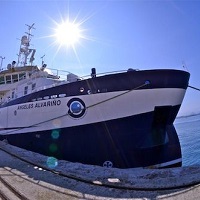
The campaign targets under TASIFE 0414, to carry on board the research vessel Angeles Alvariño, are the set up and maintenance of equipment deep underwater photography TASIFE 2013. Specific objectives focus on the investigation of benthic Banks areas of 'Reserva Marina de La Palma' and 'ZEC Franja Marina Teno-Rasca (Tenerife)' by direct and visual methods. Specifically: · Extensive visual videogrammetry HD with sled towed "NEXUS". · Recognition with multibeam bathymetric probe.
 Catálogo de datos del IEO