 Catálogo de datos del IEO
Keyword
multi-channel seismic reflection systems
20 record(s)
Type of resources
Categories
Topics
INSPIRE themes
Keywords
Contact for the resource
Provided by
Years
Formats
Status
-

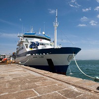
The EM 300 campaign was the first of those carried out by the B / O Vizconde de Eza. The first part of the same was used for the calibration and start-up of the multibeam echo sounder system that the vessel is equipped with, basically consisting of an EM-300 multibeam echo sounder, a Seapath-200 motion sensor, a D Seastar GPS, a GPSD Fugro, a SV Plus sound speed sensor and a Sun Ultra5 workstation, for data acquisition, with a plotter for printing the obtained data.
-
<p>The MARLBORO cruise project aimed to study Post-Messinian tectonic evolution in the South Alboran basin (Morocco). The presence of sediment formations, especially contourites (sediments deposited or reworked by marine bottom currents) and instabilities, deposited since the end of the Messinian (approx. 5.33 Ma), provide us with top rate sedimentary markers to recreate the tectonic evolution well. Moreover, the region is affected by strong quakes and by slope instabilities which cause concern. Although active accidents have been identified and recently mapped on the Andalusia margin, no such detailed studies have been conducted yet on the Moroccan margin. The Xauen/Tofino and Alboran ridges off Morocco, in the south of the Alboran Sea, were chosen for the study zone since they show both past and current signs of strong tectonic deformation, underwater landslides and activity of bottom currents whose contourite type deposits can provide an excellent stratigraphic marker. The cruise's objective was the imaging of post-Messinian structures using medium resolution reflection seismics. The cruise (7 days in the zone) made it possible to acquire about 1,100 km of reflection seismic surveys along the 15 profiles perpendicular to the ridges, and 3 profiles parallel to the ridges, in order to monitor the lateral and longitudinal evolution of contourites and of Mass Transport Deposits (MTDs), as well as the geometric relationships existing between these objects and active tectonic structures. The MARLBORO cruise is related to the French TerMex (Mediterranean margin) and Actions Marges (Améditer) programmes as well as to Spanish national Contouriber and SAGAS programmes and the international Topomed programme.</p>
-
Characterization of the Quaternary and Neogene sedimentary cover of the NW Atlantic shelf zone off Morocco and Quaternary deformations. This falls under the ANR ISIS project.
-
Studying the Messinian Salinity Crisis on the Balearic promontory and using its markers to assess post-crisis vertical movement and the reactivation of the region. 1) Fine-scale continuous mapping of evaporites from land to the deep basin in order to answer the following question: What is the spatial-temporal variability of evaporites of the Balearic Promontory (evaporites on land, very thin or thick evaporates at sea)? 2) Using the Messinian as a marker of syn- and post-MSC deformations; isolating recent movements from previous deformations and quantifying them in order to reproduce the paleo-bathymetry and paleo-connections during the crisis. Were the evaporites in shallow basins continuous with evaporites in deeper basins before the recent deformations? The related project is 'Action Marges', Mediterranean study site.
-
Technological trials run on seismic equipment developed by the SERCEL firm.
-
The ZEE-2001-EZA campaign was part of the program "OCEANOGRAPHIC HYDROGRAPHIC STUDY OF THE EXCLUSIVE SPANISH ECONOMIC ZONE" (PIHOZE), approved by the Council of Ministers, dated April 22, 1993, and carried out by the Hydrographic Institute of the Navy (IHM) and the Spanish Institute of Oceanography (IEO). The ZEE-2001-EZA campaign aimed to carry out the necessary work to obtain the hydrographic-oceanographic knowledge of the eastern part of the Canarian Archipelago, mainly the areas adjacent to the Islands of Fuerteventura and Lanzarote and complete the work carried out during the campaigns Zee-98, Zee-99 and Zee-00, carried out aboard the B.I.O. Hesperides
-

<p>?The cruise took place from 22 November to 20 December 2006 aboard RV L'Atalante. Its objective was to study the formation of passive continental margins and a special sedimentary sequence which exists all over the Mediterranean. The result of national (IUEM Brest, Géosciences Azur, University of Lille, UPMC) and European (Universities of Lisbon and Bologna, GEOMAR and AWI) cooperation, directed by Ifremer, the cruise mobilized some twenty scientists for nearly one month. The related project is GDR Marges.</p>
-

The objective of the CIRCAROCK0521 survey is to obtain the necessary information that will allow “identifying and evaluating the environmental status of circalittoral and rocky bathyal habitats”. The specific objectives that are proposed are: 1. Identify structuring species that characterize rocky circalittoral habitats. 2. Know the distribution of rocky circalittoral habitats. 3. Identify environmental variables involved in the distribution of rocky circalittoral habitats. 3. Compile information that is necessary to calculate the status and condition indicators that allow evaluating the conservation status of the different rocky circalittoral habitats. Additionally, the survey will allow documenting the rocky bottoms of the Cantabrian Sea and the Galician Atlantic coast in order to achieve the following secondary objectives: - Studies with multibeam probe and topas for mapping the rocky bottoms and characterization of the geomorphology of the area. - Document recording video and photo the species that characterize the different rocky circalittoral habitats. - Identify typical species of rocky circalittoral habitats from samples obtained with the rock dredge. - Prepare a catalog of species in which the taxonomy, the visual aspect and different biological and ecological characteristics of the different species are related.
-
GEOLOGY PROSPECTION OF THE SEA FLOOR. PERFORM HIDROGRAPHIC SURVEYS, CONDUCT OF GEOPHYSICAL EXPLORER, IMAGING DEEP SEA, CHARTING MAPPED FISHING AREA OF DE ZEE SPANISH WATERS.
-
GEOLOGY PROSPECTION OF THE SEA FLOOR. PERFORM HIDROGRAPHIC SURVEYS, CONDUCT OF GEOPHYSICAL EXPLORER, IMAGING DEEP SEA, CHARTING MAPPED FISHING AREA OF DE ZEE SPANISH WATERS.