 Catálogo de datos del IEO
Keyword
Litter abundance and type
63 record(s)
Type of resources
Categories
Topics
INSPIRE themes
Keywords
Contact for the resource
Provided by
Years
Formats
Status
-

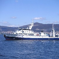
The objective of the CIRCAROCK0521 survey is to obtain the necessary information that will allow “identifying and evaluating the environmental status of circalittoral and rocky bathyal habitats”. The specific objectives that are proposed are: 1. Identify structuring species that characterize rocky circalittoral habitats. 2. Know the distribution of rocky circalittoral habitats. 3. Identify environmental variables involved in the distribution of rocky circalittoral habitats. 3. Compile information that is necessary to calculate the status and condition indicators that allow evaluating the conservation status of the different rocky circalittoral habitats. Additionally, the survey will allow documenting the rocky bottoms of the Cantabrian Sea and the Galician Atlantic coast in order to achieve the following secondary objectives: - Studies with multibeam probe and topas for mapping the rocky bottoms and characterization of the geomorphology of the area. - Document recording video and photo the species that characterize the different rocky circalittoral habitats. - Identify typical species of rocky circalittoral habitats from samples obtained with the rock dredge. - Prepare a catalog of species in which the taxonomy, the visual aspect and different biological and ecological characteristics of the different species are related.
-
Abundance indices, distribution patterns and faunal assemblages of demersal species in the northern coast of Spain (Atlantic Galician shelf and Cantabrian sea shelf), together with the possible driving factors of their distribution
-

Set up techniques of circalittoral benthic habitat study of sedimentary seabeds, including identification and cartography of habitat and characterization of benthic communities, aiming to develop MSFD indicators.
-
Identification and mapping of habitats. Characterization of benthic communities through the acquisition of underwater images, bathymetric data of the bottom and of the surface structure, and sampling with rock dredge, van veen and shipek. Identificación y cartografía de hábitats. Caracterización de comunidades bentónicas mediante la adquisición de imágenes submarinas, datos batimétricos de la superficie del fondo y de la estructura superficial, y muestreos con draga de roca, van veen y shipek.
-
Evaluation of demersal and benthic ecosystem in the northern coast of Spain, using bottom trawl surveys
-
To estimate the spawning stock biomass of european anchovy (Engraulis encrasicolus) in the Bay of Biscay in spring.
-
To estimate the spawning stock biomass of european anchovy (Engraulis encrasicolus) in the Bay of Biscay in spring.
-
Estimating the abundance and population structure of the target species of the trawl fishery in the Mediterranean, identified in the MEDITS project (Annex I), studying the biology of exploited communities on the shelf and upper slope of the study area and the impact of fishing on ecosystems.
-
Estimating the abundance and population structure of the target species of the trawl fishery in the Mediterranean, identified in the MEDITS project (Annex I), studying the biology of exploited communities on the shelf and upper slope of the study area and the impact of fishing on ecosystems.
-
Estimating the abundance and population structure of the target species of the trawl fishery in the Mediterranean, identified in the MEDITS project (Annex I), studying the biology of exploited communities on the shelf and upper slope of the study area and the impact of fishing on ecosystems.