Keyword
acoustic backscatter sensors
95 record(s)
Type of resources
Categories
Topics
INSPIRE themes
Keywords
Contact for the resource
Provided by
Years
Formats
Status
-

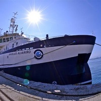
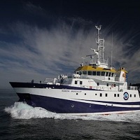
Main targets of PECAN are: - Setting-up of R/V Ángeles Alvariño as acoustic-fisheries prospecting vessel. - Optimizing sampling design for the systematic study and abundance estimating of Canary Islands pelagic species. - Using echo integration as a method to estimate Canary Islands pelagic species abundance.
-

Main targets of PECAN are: - Setting-up of R/V Ángeles Alvariño as acoustic-fisheries prospecting vessel. - Optimizing sampling design for the systematic study and abundance estimating of Canary Islands pelagic species. - Using echo integration as a method to estimate Canary Islands pelagic species abundance.
-

This survey has been projected in the frame of La Restinga Volcano monitoring. After a wide number of surveys conducted by R/V Ramon Margalef during the volcano crissis (from october 2011 to february 2012) the aim this time is to compleate a bathymetric surver again in order to find out possible changes in geomorphology, Sound velocity profiles will be carried out in order to obtain the best accuracy on the data adquired.
-

This survey main goal is to achieve the complete bathimetry of the designated area using multibeam echosounder EM710. After data procesing different DTM will be produced in order to characterize the area from a geomorphologic point of view. Sound velocity profiles will be carried out in order to obtain the best accuracy on the data adquired.
-

Main targets of PECAN 1602 are: - Setting-up of R/V Ángeles Alvariño as acoustic-fisheries prospecting vessel. - Optimizing sampling design for the systematic study and abundance estimating of Canary Islands pelagic species. - Using echo integration as a method to estimate Canary Islands pelagic species abundance.
-

Main targets of PECAN 1602 are: - Setting-up of R/V Ángeles Alvariño as acoustic-fisheries prospecting vessel. - Optimizing sampling design for the systematic study and abundance estimating of Canary Islands pelagic species. - Using echo integration as a method to estimate Canary Islands pelagic species abundance.
-

The objective of the NUREIEVA-3D campaign is the acquisition of a high-resolution 3D seismic cube of the submarine extension of the Portmán Bay mining spill deposit, in the vicinity of Cartagena, Murcia province, in order to establish the geometry and three-dimensional internal structure of said reservoir. To carry out the campaign, it will be necessary to install, test and deploy from the ship a complete 3D seismic system that will be provided by the subcontracted company GeoSurveys
-

The goals of this campaign are framed within the objectives of the overall project 'Radial Profunda de Canarias', being the experimental cruise of the proposal. Thus, this cruise will help to: • Determine the structure of the current when it reaches the Canary Islands, of the Outcrop Current and the polar counterflow of slope in its passage through the Canary Archipelago and the African slope, stimating its mass transport, heat and nutrients. • Characterize the different modes of variability of heat and mass transport in easternorth atlantic subtropical gyre and the oucrop in northwest African coast. • Characterize the annual cycle in the physical conditions of the surface layers and mixture to where the seasonal cycle is significant, relating it to the meteorological forcings. • Characterization of changes in water masses, mainly in the North Atlantic Central Water (NACW), in Antarctic Atlantic Intermediate Water (AAIW) in Mediterranean Water (MW), bottom waters of the Canary Basin and the oucrop in northwest African coast, in based on temperature, salinity, nutrients and oxygen. • To characterize the zooplancton and micronecton deep communities. • To charactereze the microbian and heterotrophic communities.
-

The main objective of this Survey is to assess the conservation status of habitat 1120 Posidonia oceanica in the Gorguel area and its surroundings. Additionally, a detailed geophysical survey (multibeam and TOPAS) will be carried out in areas adjacent and close to the posidonia meadows in order to delimit their possible extension, both on the surface and in depth.
-

Impact of exploitation of mineral resources on the deep-sea ecosystems (MIDAS project)
 Catálogo de datos del IEO