Keyword
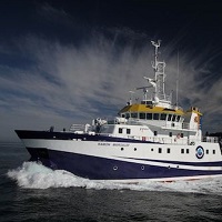
Ramon Margalef
181 record(s)
Type of resources
Categories
Topics
INSPIRE themes
Keywords
Contact for the resource
Provided by
Years
Formats
Status
-

The main goal of the INDEMARES CHICA 1011 oceanographic cruise was to study the seafloor geomorphology in order to explore new areas associated with habitats related to the gas seepages in the Gulf of Cadiz. For this, a mosaic of the multibeam bathyme try, very high-resolution seismic profiles and submarine video and photographic transect was made. The survey was carried out between the 20th October 2011 and the 1st November 2011 having Cadiz as a base port. The majority of the days was bad-weather; in fact, we had to come back to the port on 27th October owing to the stormy weather. It has been obtained a total of 1636 nautical miles of bathymetric and seismic data from the upper continental slope of the Gulf of Cadiz. The prospected area was of 2,550 km2 located between 100 and 900 m depth. The multibeam echosounder was calibrated daily by means of sound velocity profiles. Photographic transects were made on 21, 26 and 31 october, in Gazul and Albolote mud volcanoes and in the head of one canyon situated in the south of the study area.
-

Analisys of Dinophysis acuminata phytoplankton presence over the Galician west coast.
-

Study of different sectors of the Mediterranean margins of Andalusia to analyze the potential existing active tectonic structures, capable of generating geological risks either due to the generation of earthquakes, or secondarily due to the triggering of landslides and / or tsunamis.
-

Bathymetry and seismic work on the coast of the island of Menorca (Baleares Islands)
-

In this cruise the mooring lines deployed in April 2012 have been recovered. In addition communication between acoustic receivers and a deck unit has been tested. This is part of the international program OTN ("Ocean Tracking Network," in Spanish "Red de Seguimiento Oceánico"). This work is preparatory for the deployment of a curtain listening across the Strait of Gibraltar.
-

Estimate Nephrops norvegicus abundance in the gulf of Cadiz by underwater video recordings.
-

Historical series of oceanographic data in the Vigo Estuary and adjacent platform.
-

The objective of the NUREIEVA-3D campaign is the acquisition of a high-resolution 3D seismic cube of the submarine extension of the Portmán Bay mining spill deposit, in the vicinity of Cartagena, Murcia province, in order to establish the geometry and three-dimensional internal structure of said reservoir. To carry out the campaign, it will be necessary to install, test and deploy from the ship a complete 3D seismic system that will be provided by the subcontracted company GeoSurveys
-

ROV evaluation to analyze fishing pressure on benthic habitat
-

Historical series of oceanographic data in the Vigo Estuary and adjacent platform.
 Catálogo de datos del IEO