Keyword
Algeciras
17 record(s)
Type of resources
Categories
Available actions
Topics
INSPIRE themes
Keywords
Contact for the resource
Provided by
Years
Formats
Status
-
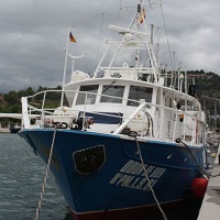
FONDEO DE UNA LINEA DE 5 CORRENTOMETROS EN EL ESTRECHO DE GIBRALTAR A UNA PROFUNDIDAD DE 450 m\nPERFILES DE CTD
-

FONDEO DE CADENA DE TERMISTORES Y 3 CORRENTOMETROS EN PUNTA EUROPA, AL SUR DEL ESTRECHO DE GIBRALTAR.\nSONDEO CON CTD EN LA BOCA ESTE DEL ESTRECHO PARA CONOCIEMIENTO DE LA HIDROLOGIA DE LA ZONA.
-

To estimate nitrogen (NH4+, NO2-, NO3-), phosphate and silicate fluxes in the Strait of Gibraltar, to quantify and characterise the fluxes of particulate organic carbon and nitrogen (POC/PON) and to estimate of picoplankton, nanoplankton and microplankton biomass distribution in the Strait of Gibraltar. To describe the hydrological structure and the geochemical fields of the region of the Gulf of Cadiz, particularly at the levels influenced by the Mediterranean waters, in order to set a background for interpreting the dynamics of the Outflow
-

Cr. CANALES CNL-0396 - ref CEDO 9601
-

LOCALIZACION DEL CHORRO ATLANTICO ENTRANTE POR EL ESTRECHO DE GIBRALTAR, FRENTES TERMICOS Y HALINO ASOCIADO Y ZONAS DE AFLORAMIENTO AL NOROESTE DEL MAR DE ALBORAN
-
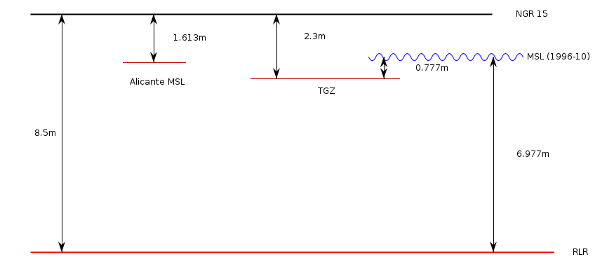
El mareógrafo de Algeciras estaba situado en la zona portuaria registranso datos del nivel del mar desde 1943 a 2002. Esta estación fue reemplazada por otra (PSMSL ID 2117) recogiendo datos desde 2006 en adelante.
-
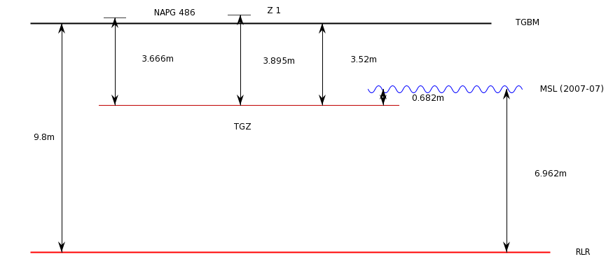
El mareógrafo de Algeciras está situado en la zona portuaria y registra datos del nivel del mar desde noviembre de 2006. Esta estación viene a reemplazar el anterior mareógrafo (PSMSL ID 490) que estuvo tomando registros desde 1943 a 2002.
-
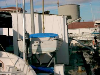
El mareógrafo de Málaga está situado en la zona portuaria y registra datos del nivel del mar desde 1943, con una ausencia de registros entre 1959 y 1961.
-
<p style="margin-left:0cm; margin-right:0cm">This multidisciplinary and integrated study comprises geophysical, sedimentological and (bio)geochemical data and aims to present a holistic view on the interaction of both environmental and geological drivers in cold-water coral mound development in the Gulf of Cadiz. In this context, it was fundamental to obtain "samples from the deep" to explore and characterize the biodiversity thought (1) geophysical and video imaging, (2) targeted microbiological profiling, (3) evaluation of present and past oceanic conditions.</p> <p style="margin-left:0cm; margin-right:0cm">Targeted microbiological and biogeochemical transects with long sediment cores were proposed to elicit the 3D spatial architecture and diversity of the microbial mound community and its possible role in slope stabilization. Off-mound cores were also targeted in order to evaluate present and past oceanic conditions by dating of the cored sequences and by reconstruction of water mass and sedimentary dynamics variability for eliciting the time frame of natural biodiversity changes.</p> <p style="margin-left:0cm; margin-right:0cm">The key objective aiming to investigate the microbial diversity and the functional link microbes-metazoans was addressed through biogeochemical approaches (biomarkers), molecular fingerprinting (DGGE, 16S rRNA), fluorescence in situ hybridization (FISH) and laboratory culture. This also includes the analysis of microbial infestation of coral frame builders and fauna-microbe interactions, in general, and the analysis of microbially mediated processes of carbonate precipitation, at various sites and scales: coral mucus, carbonate crusts, mound slopes, mound interior.</p> <p style="margin-left:0cm; margin-right:0cm">The sites targeting was mainly prepared by geophysical surveying (high-resolution sparker seismics, multibeam bathymetry) and ROV imagery, performed by RCMG (Ghent University). Especially the location of all on-mound core sites was determined from interpretation of the ROV Genesis dives during the CADIPOR III campaign of June 2007 on board of R/V Belgica. Additional information was made available through cooperation within past or ongoing European projects such as ESF EuroMARGINS "Moundforce", EC FP5 RTN "EURODOM" and EC FP6 IP "HERMES". Although the MiCROSYSTEMS-MD169 cruise focus was on the Pen Duick Escarpment (PDE), (8 sites, Figures 1 and 2) also other sites such as Conger Cliff (Vernadsky Ridge) and Mercator Mud Volcano were sampled. Special attention was given to the two proposed drill sites for IODP Full proposal 673 "Atlantic Mound Drilling 2: Morocco Margin". A total of five main site locations were identified:<br> 1)The Pen Duick Mounds: Alpha, Beta, Gamma and Epsilon Mounds,<br> 2) The Vernadsky Ridge mounds: Conger Cliff,<br> 3) A depression site at the foot of PDE,<br> 4) Palaeoceanographic reference sites,<br> 5) Mercator Mud Volcano.</p> <p style="margin-left:0cm; margin-right:0cm; text-align:center"><img alt="" src="https://campagnes.flotteoceanographique.fr/campagnes/8200100/images/426.png" style="height:244px; width:500px"></p> <p style="margin-left:0cm; margin-right:0cm"><em>Figure 1: Shipboard map of the SF11 multibeam bathymetry with site tracks.</em></p> <p style="margin-left:0cm; margin-right:0cm">The coring and subsampling strategies used during this campaign were predominantly site-dependent, distinguishing between "on-mound" and "off-mound" sites. Every on-mound site was cored at least two times; one core for geochemistry and microbiology, to be sampled immediately on board, and a second core for sedimentology, palaeoceanography and chronostratigraphy, to be left unopened and stored immediately.
-

MANTENIMIENTO DE UNA LINEA DE 5 CORRENTOMETROS Y CADENA DE TC \nFONDEO DE UNA LINEA DE 7 CORRENTOMETROS Y CADENA TC\nFONDEO LINEA DE 6 CORRENTOMETROS
 Catálogo de datos del IEO