Keyword
particulates samplers
14 record(s)
Type of resources
Categories
Topics
INSPIRE themes
Keywords
Contact for the resource
Provided by
Years
Formats
Status
-

To collect relevant information to evaluate The levels of eutrophication in the coastal strip between Algeciras and Barcelona (Iberian coast, Alborán Sea and NW Mediterranean).
-
The impact of trawling activity on a highly vulnerable habitat: the facies of Isidella elongata, a characteristic facies of Mediterranean deep sea communities, which is surprisingly a poorly known ecosystem.
-

The EU funded MIDAS RTD project (7th FP, gran agreement 603418) overarching objective is to determine the impact of deep-sea mining on deep marine ecosystems. The eruption of the submarine volcano of El Hierro in 2011_12 and its impacts on the ecosystem are, in some aspects, a possible analog of deep ocean mining. The was focused on the research of the effects on the seabed and benthic and pelagic ecosystems of nepheloid layers and acidic waters resulting from the eruption. Inspection tasks has been carried out and, when possible, sampling of rocks, sediments and water by the ROV "Liropus 2000. Sampling of surface sediments through multicore, box-corer and Van Veen grab, and profiling and sampling of the water column, especially near the bottom, using CTD with rosette. The areas studied are the slope where the eruption and sectors more or less close with varying degrees of involvement took place, including sectors not affected in both flanks of El Hierro. Work out bathymetric mapping and seismic profiling also are been made.
-

The NUREIEV2 cruise targets the main objective of testing the hypothesis that sea storms are the main trigger for the transfer of matter and energy, including pollutants and litter, from the coastal to the deep ocean in the SE of Spain (36º20’N to 37º36’N and 2º40’W to 0º40’W). A dedicated strategy was performed during the NUREIEV2 cruise to achieve the objective including: 1) the collection of sediment cores (multicores) in the vicinity of the mine tailings deposit near the Portman Bay 2) the recovery and redeployment of mooring lines with automated sediment traps and currentmeters to monitor particle fluxes (including pollutants released from the mine tailings deposit) and near bottom oceanographic parameters (current speed and directions, temperature, transmissivity), 3) the profiling of the water column (by means of a CTD) to study physico-chemical characteristics of the water column, 4) the collection of floating debris including microplastics from surface waters 5) and the high resolution swath mapping and TOPAS profiling to investigate seafloor features.
-

The leg 1 of the NUREIEV 3 oceanographic cruise took place from 22 to 30 April 2016. The area of work has located on the continental margin of the SE of Iberian Peninsula, off the coast of Murcia and Almeria, with reference coordinates from 36º20'N to 37º36'N and 2º40'W to 0º40'W. The tasks performed consisted of: • Bathymetric mapping with multibeam echosounder for seabed mapping, from inner shelf to upper slope (50 to 1500 m depth). • Geophysical works with TOPAS, very high resolution seismic profiles, to characterize the sedimentary cover of the study area. • Recovery of 5 mooring lines, instrumented for the continuous monitoring of the hydrological (water masses) and sediment (particle fluxes) dynamics from the last cruise in September 2015. Each mooring line is composed by one current meter for measuring temperature, turbidity, velocity and direction of currents and one sediment trap for sampling sinking particles. In addition, each mooring is equipped with an acoustic release for recovery and with suitable buoyancy. Monitoring with instrumented mooring lines has covered an annual cycle, in two phases of 6 months each one. • CTD profiling and water sampling. Profiles have been made in each of the submarine canyons monitored for measuring physical and chemical variables of water column (temperature, salinity, turbidity, oxygen concentration and chlorophyll) and calibration of instruments of mooring lines. • Performing surface sampling of floating microplastics by neuston net. • Sampling of surface sediments by multicorer.
-

ROV inspection of the seafloor from the continetnal shelf to depths in excess of 1500 m, with special attention to submarine canyons. Complementary CTD castts, multibeam and sub-bottom profiler acquisition. Occasional SVPs.
-

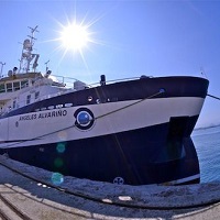
The main objective of the INTEMARES-A22B_0718 cruise, to be carried out on board the R/V Ángeles Alvariño, is to obtain the necessary information for the declaration of the seamounts of the south of Mallorca as LIC and identify habitats of community interest (according to Annex I of DH) susceptible to be included in the RN2000. The specific goals focus on the investigation of the seabed of this area, both by indirect and direct methods: - Geomorphological, structural and sedimentary characterization from the acquisition and analysis of the bathymetric and reflectivity data obtained by multibeam echo sounder (EM710) and parametric echo sounder profiles (TOPAS PS018), combined with the samples of surface sediments collected with the Box-Corer, Shipek, Van Veen and trawl dredgers.. - Start of sampling of flora and fauna for the biological characterization of the benthic communities through the use of epi-benthic beam trawl and the Box-Corer, Shipek, Van Veen and trawl dredgers.
-

The general objective of the INTEMARES-A22B-1019 campaign is to complete the geophysical mapping of the underwater mountains of the Canal de Mallorca and continue the biological characterization of its benthic and necto-benthic communities. For this, the following partial objectives are proposed: 2.1. Geomorphological and sedimentary characterization of the funds surrounding the mountains Ses Olives, Ausias March and Emile Baudot submarines, based on bathymetric data and reflectivity, obtained with EM710 multi-beam echo sounder, echo sounder profiles parametric TOPAS PS018 and surface sediment samples collected with dredgers Box-Corer and Shipek and rocks with drag dredge. Priority 1 2.2. Biological characterization of the benthic and necto-benthic communities, from of samples collected with epi-benthic skate, drag dredge and trawl experimental GOC-73 and images obtained with the TASIFE sled, in funds sedimentary and rocky previously mapped. Priority 1 2.3. Make seismic profiles with TOPAS PS018 parametric echo sounder, to obtain sedimentary structure information
-

The main target of the NUREIEVA-MAR-1 campaign is twofold. On the one hand, it aims to establish the geometry and the three-dimensional internal structure of the deposit of mineral discharges submerged in front of the Bay of Portmán and, on the other hand, it intends to verify the data obtained by obtaining witnesses from the deposit. During the campaign, a high resolution multibeam bathymetric cartography and a high density mesh of TOPAS PS18 parametric probe profiles will be carried out, and sediment tokens will be obtained by gravity or piston core grabs of the longest length possible, as well as by means of multicorer, box corer and dredge Van Veen for the upper part of the deposit. In addition, the discharge of dissolved metals from the deposit emerged at sea will be quantified using CTD profiles and sampling with hydrographic bottles. Floating microplastics will also be sampled.
-

The NUREIEV1 cruise targets the main objective of testing the hypothesis that sea storms are the main trigger for the transfer of matter and energy, including pollutants and litter, from the coastal to the deep ocean in the SE of Spain (36º20’N to 37º36’N and 2º40’W to 0º40’W). A dedicated strategy was performed during the NUREIEV1 cruise to achieve the objective including: 1) the collection of sediment cores (multicores and gravity cores) in the vicinity of the mine tailings deposit near the Portman Bay 2) the deployment of mooring lines with automated sediment traps and currentmeters to monitor particle fluxes (including pollutants released from the mine tailings deposit) and near bottom oceanographic parameters (current speed and directions, temperature, transmissivity), 3) the profiling of the water column (either from the ship by means of a CTD and from a little boat in the shallower stations) to study physico-chemical characteristics of the water column including dissolved trace elements and radiosotopes 4) the collection of floating debris including microplastics from surface waters 5) and the high resolution swath mapping and TOPAS profiling to investigate seafloor features.
 Catálogo de datos del IEO