Keyword
Geotechnics
4 record(s)
Type of resources
Categories
Topics
INSPIRE themes
Keywords
Contact for the resource
Provided by
Years
Formats
Status
-

Habitat mapping and geomorphological description of Menorca Island East shelf.
-

This survey has been projected in the frame of La Restinga Volcano monitoring. After a wide number of surveys conducted by R/V Ramon Margalef during the volcano crissis (from october 2011 to february 2012) the aim this time is to compleate a bathymetric surver again in order to find out possible changes in geomorphology, Sound velocity profiles will be carried out in order to obtain the best accuracy on the data adquired.
-

This survey main goal is to achieve the complete bathimetry of the designated area using multibeam echosounder EM710. After data procesing different DTM will be produced in order to characterize the area from a geomorphologic point of view. Sound velocity profiles will be carried out in order to obtain the best accuracy on the data adquired.
-

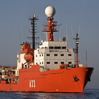
The objectives of the DETSUFA cruise (BIO Hespérides 04/03–17/03/2013) are (1) to evaluate the footprint in the seafloor of a series of earthquake-generated subaerial landslides that took place in Fiordo de Aysén, Chile, in 2007, which entered the seawater generating a number of destructive tsunamis which killed 10 and produced significant damage in the local infrastructure, (2) to reconstruct the morphology and dynamics of these landslides in order to obtain input data for tsunami modelling, and (3) to determine the occurrence of similar episodes in the past that might have generated other tsunamis, in order to establish a possible recurrence period of such events. The cruise fits within the global scientific interest stirred up by tsunamis in general, being the Fiordo de Aysén a highly relevant analogue for the understanding of this kind of events occurring in semi-enclosed basins such as fjords, lakes or water dams, which often harbour large human population and infrastructures.
 Catálogo de datos del IEO