Keyword
Punta Arenas
6 record(s)
Type of resources
Categories
Topics
INSPIRE themes
Keywords
Contact for the resource
Provided by
Years
Formats
Status
-

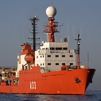
Los objetivos perseguidos han sido la investigacion de la morfoestructura, estratigraffía sísmica y evolucion geodin??mica de las placas y sub-placas que constituyen el entorno del mar de Scotia y Pen??nsula Ant??rtica. Los objetivos generales se pueden sintetizar en los siguientes puntos: a) Transicion entre diferentes placas y sub- placas; Shetland, Drake, Scotia y Ant??rtica y sus puntos de union. b) Estudio del enlace entre el centro de expansión de Bransfield y la zona de subduccion de las Shetlands del sur. c) An??lisis morfoestructural detallado de un borde de placas cizallante y de una de las grandes depresiones intracrestas (fosa Hesperides), mediante la utilizacion de las sondas multihaz.. ver Figura : mapa batim??trico de la Fosa "Hesperides" d) Establecimiento de pautas geomagn??ticas en la zona de expansion de Bransfield y en los bordes de placas cizallantes. e) Estudio de la formacion de rellenos y discontinuidades regionales en las cuencas adyacentes a la dorsal. f) Aplicacion de los modelos estudiados dentro de los planes de trabajo internacionales en dorsales Oceónicas (proyecto InterRidge
-

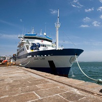
The main objective of the project ATLANTIS is the study of fishing activities and marine resources of commercial interest in the FAO statistical subareas 41.3.1 and 41.3.2, within an ecosystem approach, paying particular attention to interactions between fishing activities and Vulnerable Marine Ecosystems, mainly on the High Seas of the SW Atlantic. From 1988 the IEO scientific observers onboard programme, gives commercial, biological, oceanographic and physical data (bathymetry, surface and sea bed temperatures, etc). A series of research cruises were carried out from 2007, on board the R/V Miguel Oliver, with the main objective of said research cruises was the quantitative, qualitative and geographical study and identification of the Vulnerable Marine Ecosystems and of the vulnerable organisms in the taxonomic groups who could live in the study area, including the proposal of marine areas to be protected, to allow sustainable exploitation of fishing resources without endangering the Vulnerable Marine Ecosystems. During the research cruises undertaken, from the surface to 1,500 m, in the south western Atlantic waters between 42ºS and 48ºS, a variety of data was obtained from the fieldwork on geology, geomorphology, benthos, fisheries and physical oceanography. The results include: a detailed cartographic and bathymetric study of the area, a description of the geological substratum and of the benthic features, an analysis of the abundance and distribution of the species of largest commercial fishing interest, a footprint analysis of the fishery, an identification and a description of the Vulnerable Marine Ecosystems. The research undertaken and its main findings led to the delineating of several areas to be protected, with a total area of 41,000 km2, according to presence of organisms classified as vulnerable.
-

Hydrograpich survey. Antartctic cruise CTM2009-06256-E CTM2009-08287-E
-

A physical-geological mooring is installed at the East of Elephant Island in order to monitor the presence / absence of the Antarctic slope front on the south slope of the South Scotia Sea, and to study its role in the modification of intermediate waters of the Antarctic Circumpolar Current. The addition of a sediment trap will study the flow of sediments associated with the dynamics of the area and identify terrigenous and biogenic composition. The data obtained will be used to optimize the model of the NASA Antarctic regional (within the project ECCO2/ECCO3), the results turn will allow us to analyze our data in a global context. This project complements ESASSI AC (POL2006-11139-C02-01/CGL). In an international context, this project complements AC ECCO2's Jet Propulsion Laboratory / California Institute of Technology, NASA (USA).
-

The objectives of the DETSUFA cruise (BIO Hespérides 04/03–17/03/2013) are (1) to evaluate the footprint in the seafloor of a series of earthquake-generated subaerial landslides that took place in Fiordo de Aysén, Chile, in 2007, which entered the seawater generating a number of destructive tsunamis which killed 10 and produced significant damage in the local infrastructure, (2) to reconstruct the morphology and dynamics of these landslides in order to obtain input data for tsunami modelling, and (3) to determine the occurrence of similar episodes in the past that might have generated other tsunamis, in order to establish a possible recurrence period of such events. The cruise fits within the global scientific interest stirred up by tsunamis in general, being the Fiordo de Aysén a highly relevant analogue for the understanding of this kind of events occurring in semi-enclosed basins such as fjords, lakes or water dams, which often harbour large human population and infrastructures.
-

FICARAM cruise aims to investigate the evolution of decadal anthropogenic carbon and to evaluate the CO2 uptake capacity in the sector South Atlantic Ocean and its spread to Ecuador and Nord-tropical zone. The section of this cruise is a repeat section following the trace made in 1994 by IFREMER (Laboratoire de Physique des Oceans) into the French project CITHER as a WOCE (http://wwz.ifremer.fr/lpo/Moyens-a-la-mer/Les-campagnes-a-la-mer/Cither-2). This section was repeated in 2001 and 2002 by the Oceanology Group of the Instituto de Investigaciones Marinas of CSIC as part of CAVASSO and CARBOOCEAN European projects. This section is part of the international programs GOSHIP (http://www.go-ship.org/CruisePlans.html) and IOPCC. These programs allow the coordination between the various activities in the global ocean (http://www.go-ship.org/RefSecs/GOSHIPMap_April2011.pdf). The objectives of this cruise are framed in the EU FP7 project CARBOCHANGE (http://carbochange.b.uib.no/) under grant agreement nº 264879. Another important component of FICARAM cruise aims examine the biological and biogeochemical mechanisms that hinder total dissolved organic carbon (DOC) remineralisation in marine systems, taking a multidisciplinary perspective and applying many different approaches. This objective is the global objective of the Spanish project DOREMI that join this FICARAM cruise. Along the section, the DOREMI project will test the effect of different factors (carbon and nutrient additions, and microbial structure) on DOC degradation in epipelagic, mesopelagic and deep waters, developing some experiments determining the potential degradability of mesopelagic and epipelagic DOM, and the role that labile C supplements plays regulating this process and by the microbial structure.
 Catálogo de datos del IEO