Keyword
521
3 record(s)
Type of resources
Categories
Topics
INSPIRE themes
Keywords
Contact for the resource
Provided by
Years
Formats
Status
-

Los objetivos perseguidos han sido la investigacion de la morfoestructura, estratigraffía sísmica y evolucion geodin??mica de las placas y sub-placas que constituyen el entorno del mar de Scotia y Pen??nsula Ant??rtica. Los objetivos generales se pueden sintetizar en los siguientes puntos: a) Transicion entre diferentes placas y sub- placas; Shetland, Drake, Scotia y Ant??rtica y sus puntos de union. b) Estudio del enlace entre el centro de expansión de Bransfield y la zona de subduccion de las Shetlands del sur. c) An??lisis morfoestructural detallado de un borde de placas cizallante y de una de las grandes depresiones intracrestas (fosa Hesperides), mediante la utilizacion de las sondas multihaz.. ver Figura : mapa batim??trico de la Fosa "Hesperides" d) Establecimiento de pautas geomagn??ticas en la zona de expansion de Bransfield y en los bordes de placas cizallantes. e) Estudio de la formacion de rellenos y discontinuidades regionales en las cuencas adyacentes a la dorsal. f) Aplicacion de los modelos estudiados dentro de los planes de trabajo internacionales en dorsales Oceónicas (proyecto InterRidge
-

A physical-geological mooring is installed at the East of Elephant Island in order to monitor the presence / absence of the Antarctic slope front on the south slope of the South Scotia Sea, and to study its role in the modification of intermediate waters of the Antarctic Circumpolar Current. The addition of a sediment trap will study the flow of sediments associated with the dynamics of the area and identify terrigenous and biogenic composition. The data obtained will be used to optimize the model of the NASA Antarctic regional (within the project ECCO2/ECCO3), the results turn will allow us to analyze our data in a global context. This project complements ESASSI AC (POL2006-11139-C02-01/CGL). In an international context, this project complements AC ECCO2's Jet Propulsion Laboratory / California Institute of Technology, NASA (USA).
-

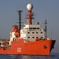
In January 2012, a physical-geological mooring was installed to the East of Elephant Island onboard the RV Hesperides. The mooring was constituted by current meters, temperature, conductivity, and pressure sensors located at selected depths. The mooring was deployed for one year period, and successfully recovered on January 23rd 2013 during the Hesperides Antarctic Survey 2012-2013. The goal of the experiment is to monitor the presence / absence of the Antarctic slope front over the southern slope of the South Scotia Ridge. The addition of a sediment trap will allow to identify the terrigenous / biogenic composition of the flow suspended particles. In an international context, the collected data will be used to optimize the MITgcm Antarctic regional model (ECCO2/ECCO3 project, JPL/Caltech).
 Catálogo de datos del IEO