 Catálogo de datos del IEO
Keyword
Environmental monitoring facilities
17 record(s)
Type of resources
Categories
Available actions
Topics
INSPIRE themes
Keywords
Contact for the resource
Provided by
Years
Formats
Status
-

Datos de temperatura y salinidad superficial registrados por el termosalinógrafo del B/O Naváz en la zona de la Ría de Baixas y plataforma continental adyacente.
-
El mareográfo de Puerto de la Luz (Las Palmas de Gran Canaria) está lozalizado en el dique Reina Sofía y registra el nivel del mar desde 1949.
-
El mareógrafo de Arrecife (Lanzarote) se encuentra en la zona este del puerto. Data del año 1949.
-
El mareógrafo de Cádiz está actualmente ubicado en la zona del puerto y realiza medidas de nivel del mar desde 1961.
-
El mareógrafo de Ceuta se encuentra en la zona portuaria. Data del año 1944.
-
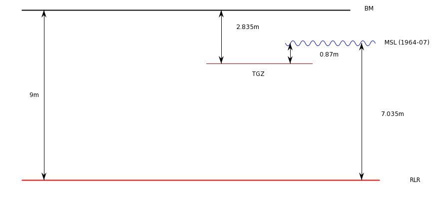
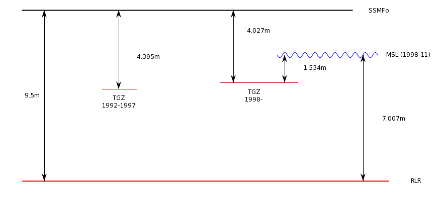
El mareógrafo de Palma de Mallorca se ubicó en la parte este del puerto de Palma, recogiendo datos de 1964 a 1966. Otra estación (PSMSL ID 1892) recoge datos desde 1997 en una localización diferente.
-
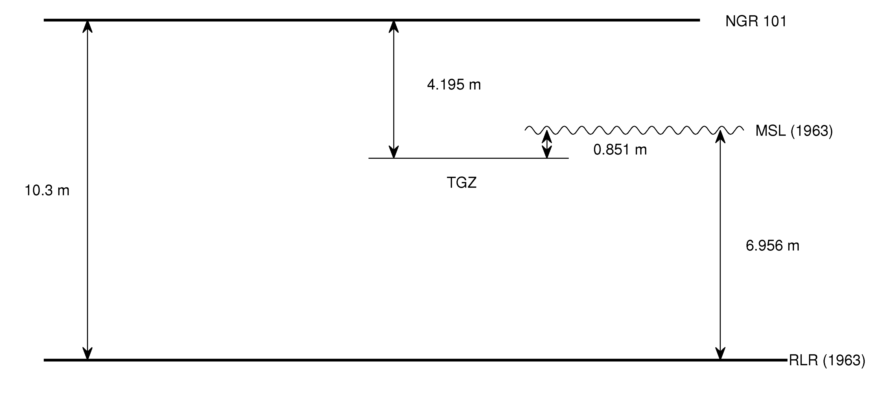
El mareógrafo de A Coruña está ubicado en las inmediaciones del Real Club Náutico y realiza medidas de nivel del mar desde 1943.
-
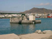
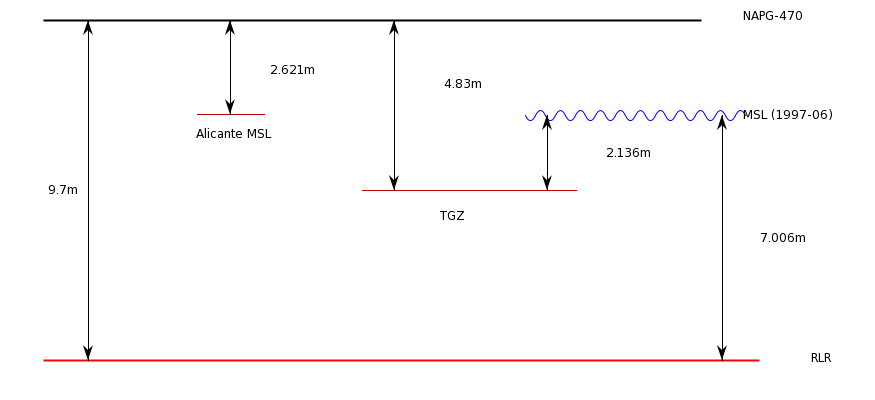
El mareógrafo de Palma de Mallorca se halla ubicado actualmente en el dique del Oeste de Palma. Data del año 1997. Otra estación cercana en el mismo puerto (PSMSL ID 1087) estuvo recogiendo datos de 1964 a 1966.
-
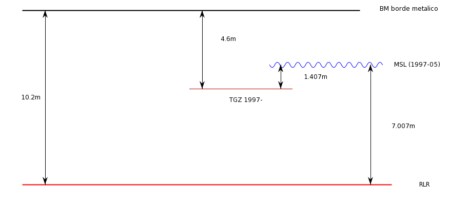
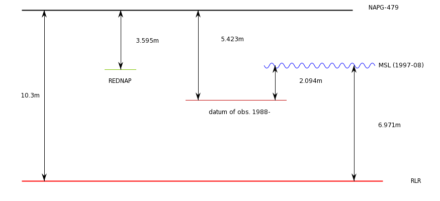
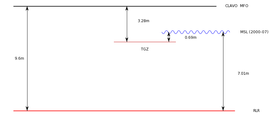
El mareógrafo de Santa Cruz de La Palma se encuentra en el puerto. Registró datos desde 1997 a 2018. Esta estación reemplazaba la estación anterior (PSMSL ID 585)
-
El mareógrafo de Vigo está actualmente ubicado en la zona del puerto pesquero de Vigo y realiza medidas de nivel del mar desde 1943.